


Winnebachsee Hut – Längenfeld/Gries
Description
GRIES PARKING LOT -> Winnebach -> Path to Winnebachsee Hut -> WINNEBACHSEE HUT
Map & elevation profile
The Tour
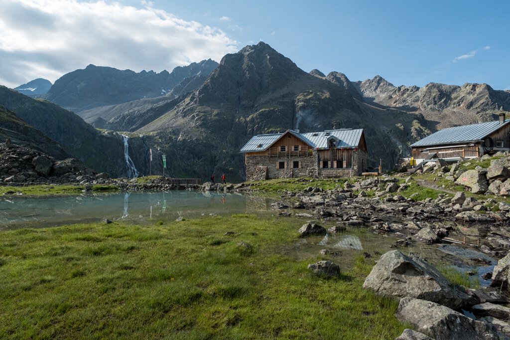
GRIES PARKING LOT -> Winnebach -> Path to Winnebachsee Hut -> WINNEBACHSEE HUT
From the parking lot at the end of Gries, follow the road to Winnebach to take the path towards Winnebachsee Hut. Soon the path leads out of the forest past numerous avalanche tracks. The well-laid path steeply ascends at the end; on the right, the Winnebach plunges down the "Bachfalle". Upon arrival at the hut, it is recommended to enjoy a wonderful rest by the lake, which is located directly behind the hut.
Bronze relief section of the Ötztal Nature Park at the start of the trail: Here you can learn information about the habitat "Wild Water" or the history of Gries.
Regions & Places
Mountain areas
Details
Characteristics
Way types
Safety guidelines
Moderately difficult mountain path; suitable for sure-footed and experienced mountain hikers; good physical condition, mountain experience, and mountain equipment (see under equipment) necessary Please pay attention to the current weather report
Additional information
More information about hiking in the Ötztal can be found here.
Directions
The start of the hike is the parking lot at the edge of Gries. From here, follow the road to Winnebach. Upon reaching Winnebach, you will find a path that first leads through the forest and then past numerous avalanche tracks to the Winnebachsee Hut.
Arrival
Public transit
Travel comfortably and safely by train. The terminus or exit point is ÖTZTAL station. Afterwards, you can travel conveniently and quickly by public bus or local taxi companies through the entire valley to your desired destination. The current bus schedule can be found at: http://fahrplan.vvt.at
Starting point
Getting there
Car journey to ÖTZTAL
Travelers arrive by car via the Inn valley up to the entrance of the valley and continue along the Ötztal. In addition to the toll motorway, country roads can also be used. Your journey can be quickly and conveniently planned with the route planner. To the route planner: https://www.google.at/maps
Parking
The following parking options are available in Gries:
Parking lot at the end of the village – paid
Current information
Midsummer-like hot
The tour is within these protected areas.
Equipment
Appropriate equipment such as breathable and weather-appropriate outdoor clothing is required for all hikes and routes. Carrying a first aid kit, a mobile phone, and possibly a hiking map, as well as sufficient provisions for hikes without opportunities for refreshments, is necessary.