

Winter route Feldringalm - No. 422
Map & elevation profile
The Tour
SATTELE -> Feldringalm -> towards Marlstein -> SATTELE
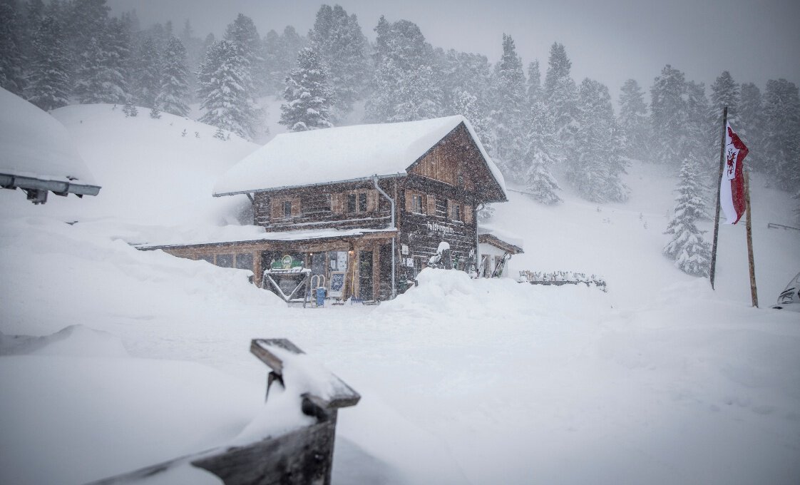
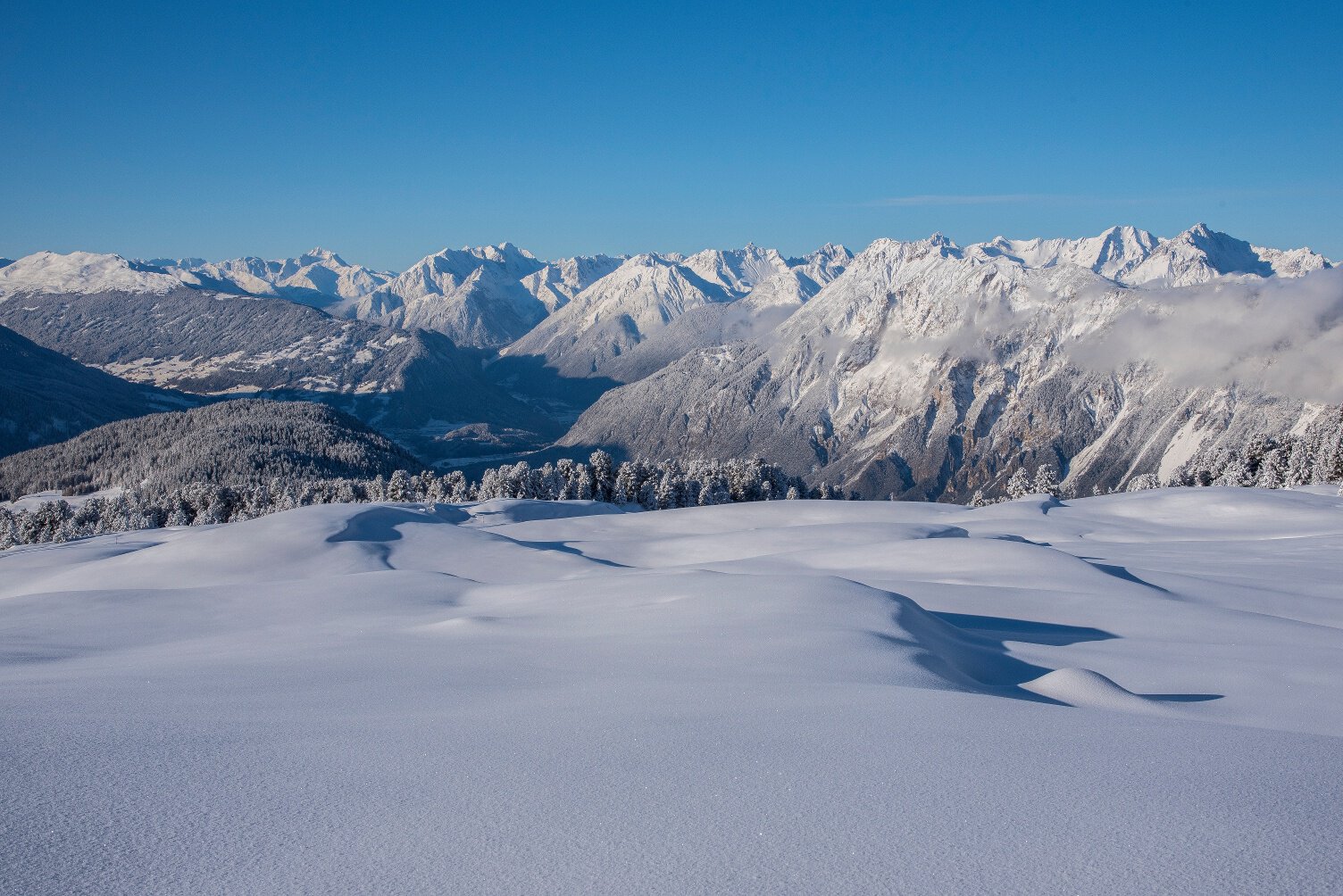
The starting point is the Sattele above Ochsengarten. On the wide forest road, you go to Feldringalm (which is also a toboggan run). Above the alpine hut begin the Feldringer alpine meadows. Hikers are rewarded with beautiful views of the Inn valley and the opposite mountainside in the Hochoetz ski area. The hiking trail leads gently downhill over a plateau to the Marlstein junction where you turn right onto a forest road towards Sattele back to the starting point.
Walking time: approx. 4 h
Please note the current snow and avalanche report for the coming days: https://www.oetztal.com/de/winter.html & https://avalanche.report/albina-web/bulletin/2019-01-07?lang=de
Regions & Places
Mountain areas
Details
Characteristics
Way types
Safety guidelines
Please note the current snow and avalanche report for the coming days: https://www.oetztal.com/de/winter.html & https://avalanche.report/albina-web/bulletin/2019-01-07?lang=de
Additional information
More information about winter hiking in the Ötztal: https://www.oetztal.com/winterwandern
Directions
The starting point is the Sattele above Ochsengarten. On the wide forest road, you go to Feldringalm (which is also a toboggan run). Above the alpine hut begin the Feldringer alpine meadows. Hikers are rewarded with beautiful views of the Inn valley and the opposite mountainside in the Hochoetz ski area. The hiking trail leads gently downhill over a plateau to the Marlstein junction where you turn right onto a forest road towards Sattele back to the starting point.
Walking time: approx. 4 h
Arrival
Public transit
Travel comfortably and safely by train to Ötztal station. At the station, you will find public transport or local taxi companies that will gladly take you to your desired destination! The current bus schedule is available at: http://fahrplan.vvt.at
Starting point
Getting there
Located in Tyrol, the ÖTZTAL branches off southwards as the longest side valley of the Eastern Alps. Traveling by car leads holidaymakers via the Inn valley to the entrance of the valley and further along the Ötztal. Besides the toll motorway, country roads can also be used. Your journey can be planned quickly and conveniently with the route planner: To the route planner: https://www.google.at/maps
Parking
The following parking options are available:
Parking lot at Sattele (via Ochsengarten)
Paid: €4 / day
Current information
Midsummer-like hot
Equipment
Appropriate equipment such as breathable and weather-appropriate outdoor clothing, wind, rain, snow and sun protection, hat and gloves is required for all hikes and routes. Carrying a first aid kit, a mobile phone, and possibly a route map, as well as sufficient provisions for tours without accommodation options, is necessary.