
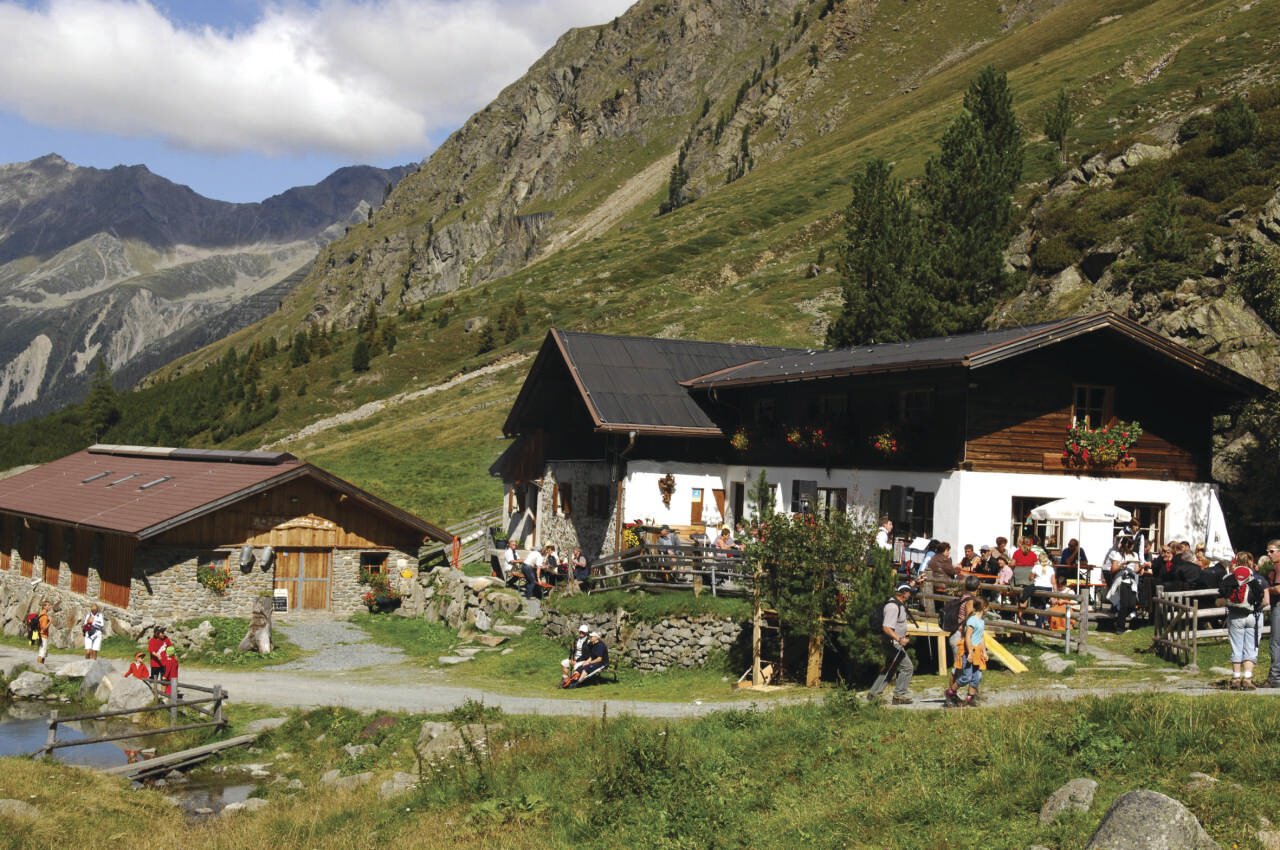
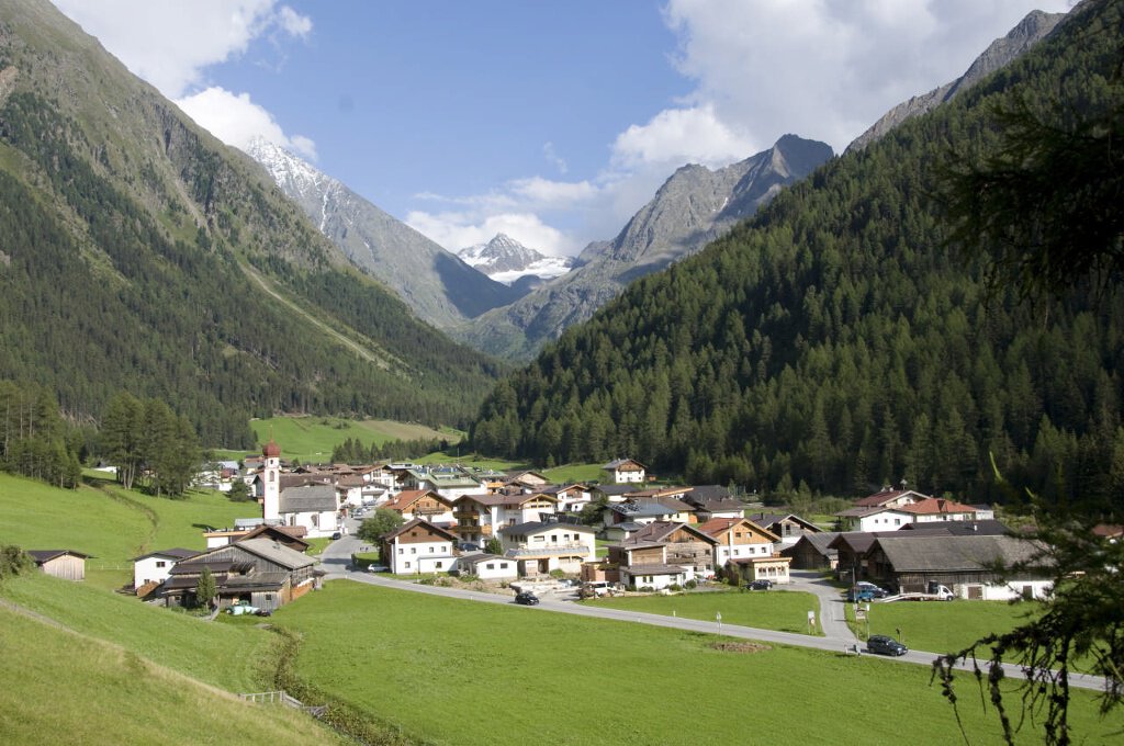


Sulztalalm - Längenfeld/Gries
Description
GRIES PARKING LOT -> towards Sulztalalm -> SULZTALALM
The Sulztalalm is closed in summer 2025 due to renovation work
Map & elevation profile
The Tour
GRIES PARKING LOT -> towards Sulztalalm -> SULZTALALM
The Sulztalalm is closed in summer 2025 due to renovation work
The starting point is the parking lot at the outskirts of Gries. From here, follow a gently ascending forest path towards Sulztalalm. Passing meadows and the Vögelasbrücke, you will soon reach the junction where you follow the forest path to the Sulztalalm. Continue hiking along the forest path with a gentle incline up to the Sulztalalm.
From the Sulztalalm, you can continue hiking towards Amberger Hut. The last 20 minutes of the path have a steeper incline.
Regions & Places
Mountain areas
Details
Characteristics
Way types
Safety guidelines
Easy hiking path; suitable for beginners and walkers. Please note the current weather report.
Additional information
More information about hiking in the Ötztal can be found here.
Directions
From the outskirts of Gries, head east along meadows to the "Vögelasbrücke". Continue via a gently ascending forest path to the Vorderen Sulztalalm.
Arrival
Public transit
Travel by train comfortably and safely. The final stop or exit point is the ÖTZTAL train station. Afterwards, you can conveniently and quickly continue with public transport or local taxi companies through the entire valley to your desired destination. The current bus timetable is available at: http://fahrplan.vvt.at
Starting point
Getting there
Driving by car to the ÖTZTAL
Arrival by car leads holidaymakers through the Inn Valley to the valley entrance and further along the Ötztal. In addition to the toll motorway, rural roads can also be used. Your journey can be quickly and conveniently planned with the route planner. To the route planner: https://www.google.at/maps
Parking
The following parking options are available in Gries:
Parking lot at the end of the village – paid
Current information
Midsummer-like hot
The tour is within these protected areas.
Equipment