


Polltalalm - Längenfeld
Description
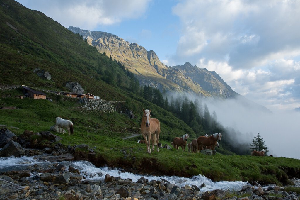
HUBEN MÜHLE -> Forest road towards Polltallam -> Junction footpath Polltalalm -> POLLTALALM
Map & elevation profile
The Tour
HUBEN MÜHLE -> Forest road towards Polltallam -> Junction footpath Polltalalm -> POLLTALALM
Starting from the district Mühle in Huben, the track leads to the Polltal and Breitlehnalm. Hikers can soon switch to the footpath, which has a steeper ascent but shortens the many switchbacks. Striking is the fern-rich larch and stone pine forest that one passes through almost all the way to the top. Upon reaching the hut, you enjoy a magnificent view of the valley and the Ötztal mountain world. Refreshed and strengthened, you return to the valley. For this, you either choose the track or first hike further to the Breitlehnalm and from there take the mountain path (a bit steeper) back to Huben.
From Polltalalm, a path leads through alpine rose meadows, blueberry and cowberry heaths as well as heather cushions to the Hahlkogelhaus (not managed - but with an impressive view of the Hahlkogel).
Regions & Places
Mountain areas
Details
Characteristics
Way types
Safety guidelines
Moderate mountain path; suitable for sure-footed and experienced mountain hikers;
Good physical fitness, mountain experience and mountain equipment (see under equipment) necessary
Please observe the current weather report at: https://www.oetztal.com/de/sommer.html
Additional information
More information about hiking in the Ötztal can be found here.
Directions
Left from the district Mühle in Huben over the small bridge, then immediately follow the wide forest road to the right. After a short time, change to the footpath which is steeper but also considerably shorter.
Arrival
Public transit
Travel comfortably and safely by train. The final stop or exit point is the ÖTZTAL train station. Afterwards, you can travel conveniently and quickly by public bus or local taxi companies through the entire valley to your desired destination. The current bus timetable is available at: http://fahrplan.vvt.at
Starting point
Getting there
Driving into the ÖTZTAL
Travelers arrive by car via the Inn valley to the valley entrance and continue along the Ötztal. In addition to the toll motorway, country roads can also be used. With the route planner, you can quickly and easily determine your journey. To the route planner: https://www.google.at/maps
Parking
The following parking options are available in Huben:
- Huben first village entrance before Tischlerei Praxmarer – free of charge
- Funpark Huben - free of charge
Current information
Midsummer-like hot
Equipment
Wearing hiking equipment such as breathable and weather-appropriate outdoor clothing, ankle-high mountain boots, wind, rain and sun protection is recommended! It is also important to bring sufficient provisions as well as a first aid kit, a mobile phone and possibly a hiking map.