


Hiking Trail
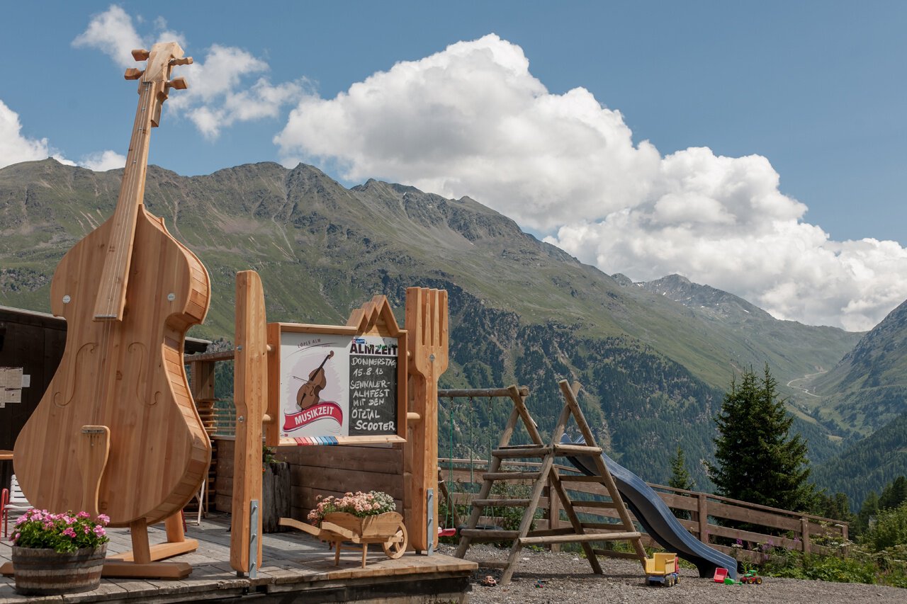
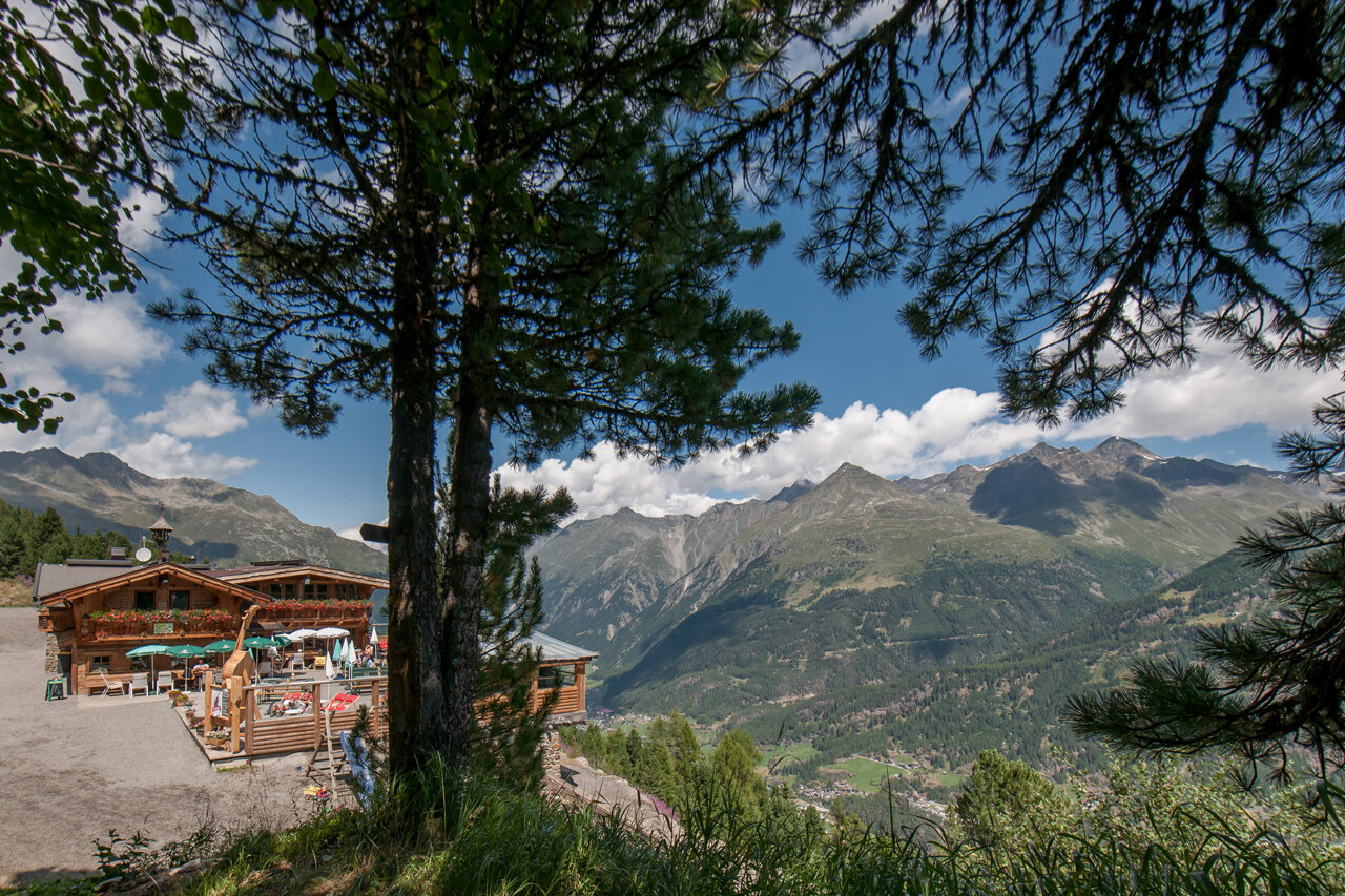
Löple Alm
Gemeinde Sölden
Top
Medium
Key facts
2:00 h
Duration
3.83 km
Length
593 m
Ascent
0 m
Descent
1,970 m
Max. altitude
1,370 m
Min. altitude
Best Season
Jan
Feb
Mar
Apr
May
Jun
Jul
Aug
Sep
Oct
Nov
Dec
Map & elevation profile
The Tour
SÖLDEN -> LÖPLE ALM -> SÖLDEN
From Sölden's church you walk on the steeply rising path to the hamlet of Innerwald, and further on to the ski slope underpass. Follow the slightly ascending forest road towards Gaislach until you reach the turn-off (signpost) to the mountain hut.
Regions & Places
Austria (Country)
Tyrol (Province)
Bezirk Imst (District)
Ötztal (Tourism area)
Sölden (Tourism area)
Gemeinde Sölden (Commune)
Mountain areas
Alps (Mountain area)
Ötztal Alps (Mountain area)
Modified at 24.03.2026 · Created at 12.06.2013
Details
Characteristics
Linear route
Scenic
Refreshment stops available
Family-friendly
Way types
Safety guidelines
Moderate mountain trail; for sure-footed and experienced hikers. Good physical condition, mountain experience & mountain equipment (see notice equipment) necessary. Please pay attention to the current weather report:
Additional information
More details about hiking In Ötztal: https://www.oetztal.com/wandern
Recommended literature
Almzeit Folder
Recommended maps
Kompass #042 | Inneres Ötztal und Pitztal
Directions
Option 1: From Sölden with the Zentrum Shuttle to Unterwald, from there across the mountain meadow to the Innerwald hamlet.
In Innerwald behind the small chapel is a meadow path towards Stiegele. From the Stiegele you can follow the wide forest path to the Gaislacher Almen.
Option 2: Ascent with the Gaislachkoglbahn to the middle station, from there follow the signs to the alpine huts on the left. Walking time approx. 40 minutes
Arrival
Public transit
Travel safe and comfortable with the train to the Ötztal Bahnhof train station. Last stop and exit point is the train station Ötztal Bahnhof. Afterwards you can travel smoothly and quick with the public transport or our local taxi companies through the valley to your desired destination. Please find the current bus timetable here:http://fahrplan.vvt.at
Starting point
Sölden
Getting there
The car drive to the Ötztal valley. Situated in Tirol, the Ötztal valley set off in southerly direction and is thelongest side valley in the Eastern Alps. The journey with the car leads you through the Inntal valley to the entrance of the valley and further on through the valley. Among the toll motorways you can also use the countryroads. A route planner will show you the easiest and most convenient way: https://www.google.at/maps
Parking
The following parking facilities are available in Sölden:
- Parking lot
- parking lot Stiegele
- stair parking
- Giggijochbahn + underground garage
- Gaislachkoglbahn + underground garage
- Parking Hochsölden
- parking garage Hochsölden 1. parking lot
All parking is free during the day.
Parking for several days (eg hike tour):
- Parkgarage Gaislachkoglbahn, Parkticket either online or directly at the cash desk of the Gaislachkoglbahn
Equipment
Appropriate equipment such as breathable suitable outdoor clothes for the weather, ankle-high walking boots,wind-, rain- & sun protection, hat, possibly gloves, is for all hikes and tours necessary. Please bring a first-aidbox, a mobile phone, a walking map and if there is no hut on the way a snack and enough to drink.