
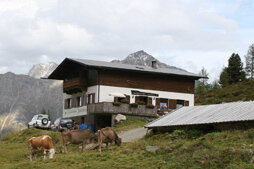


Innerbergalm - Längenfeld
Description
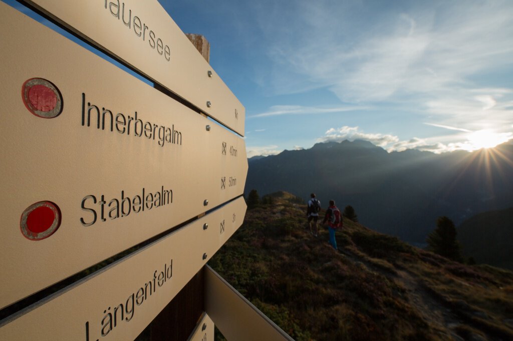
LÄNGENFELD/LEHN -> Trail towards Stabelealm -> Stabelealm -> INNERBERGALM
Map & elevation profile
The Tour
LÄNGENFELD/LEHN -> Trail towards Stabelealm -> Stabelealm -> INNERBERGALM
From the parking lot in Lehn (near the via ferrata entrance) the mountain trail steadily ascends towards Stabelealm. Along the path you cross or see the Lehner Wasserfall. The trail steadily ascends beyond the tree line up to the Stabelealm. From there, you only follow the hiking trail for about 30 minutes until you reach the Innerbergalm.
There is a second option to reach the Innerbergalm via a wide but longer forest road starting in Unterried. First, follow the signs towards Wurzbergalm, then the winding path to Leckalm. From there the forest road passes the Stabelealm to the Innerbergalm. (Duration: approx. 4 hours)
The Innerbergalm is also accessible via the Lehner Wasserfall via ferrata. (Follow the via ferrata path to Innerbergalm) Duration: approx. 2 hours
Regions & Places
Mountain areas
Details
Characteristics
Way types
Safety guidelines
Moderately difficult mountain trail; suitable for sure-footed and experienced mountain hikers; good physical condition, mountain experience, and mountain equipment (see under equipment) necessary. Please pay attention to the latest weather report.
Additional information
The hut taxi to Innerbergalm runs once weekly during the summer season.
Reservation is required.
Ötztal Tourism - Information Längenfeld +43 (0)57200 300
More information about hiking in the Ötztal can be found here.
Directions
There are 2 different ways to reach the Innerbergalm.
Option 1: From Lehn near the via ferrata entrance via the steep mountain trail towards Innerbergalm. (Duration: approx. 2.5h)
Option 2: Via a wide but longer forest road starting from Unterried via the Wurzbergalm and the unmanaged Leckalm. (Duration: approx. 4h)
Arrival
Public transit
Travel comfortably and safely by train. The final stop or exit point is the ÖTZTAL train station. Afterwards, you can travel conveniently and quickly by public bus or local taxi companies through the entire valley to your desired destination. The current bus schedule is available at: http://fahrplan.vvt.at
Starting point
Getting there
Driving into the ÖTZTAL
Traveling by car takes visitors through the Inn Valley to the entrance of the valley and continues along the Ötztal. Besides the toll highway, country roads can also be used. Your route can be determined quickly and conveniently with the route planner. To the route planner: https://www.google.at/maps
Parking
The following parking options are available in Längenfeld:
Parking lot in Lehn – near the local history museum – fee required, €3.00 (Option 1)
Parking lot in Unterried - start of hike to Wurzbergalm - free (Option 2)
Current information
Later changeable
Mostly pleasantly warm
Equipment
Proper equipment such as breathable and weather-appropriate outdoor clothing is required for all hikes and routes. Taking a first aid kit, a mobile phone, and possibly a hiking map, as well as sufficient provisions for hikes without catering options, is necessary.