

Alpengasthof Feuerstein - Längenfeld/Huben
Map & elevation profile
The Tour
HUBEN FOOTBALL FIELD -> Forest path -> ALPENGASTHOF AM FEUERSTEIN
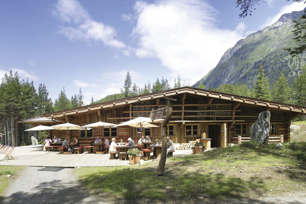
The Alpengasthof Feuerstein was newly built a few years ago. With plenty of extra wood in front and inside the hut, the building represents a piece of lived Ötztal tradition. Its interior skillfully bridges the gap between old and modern.
The ascent starts on the forest path from the football field in Huben. Initially, it runs with a gentle incline. The last stretch just before the hut draws the last bit of strength out of you.
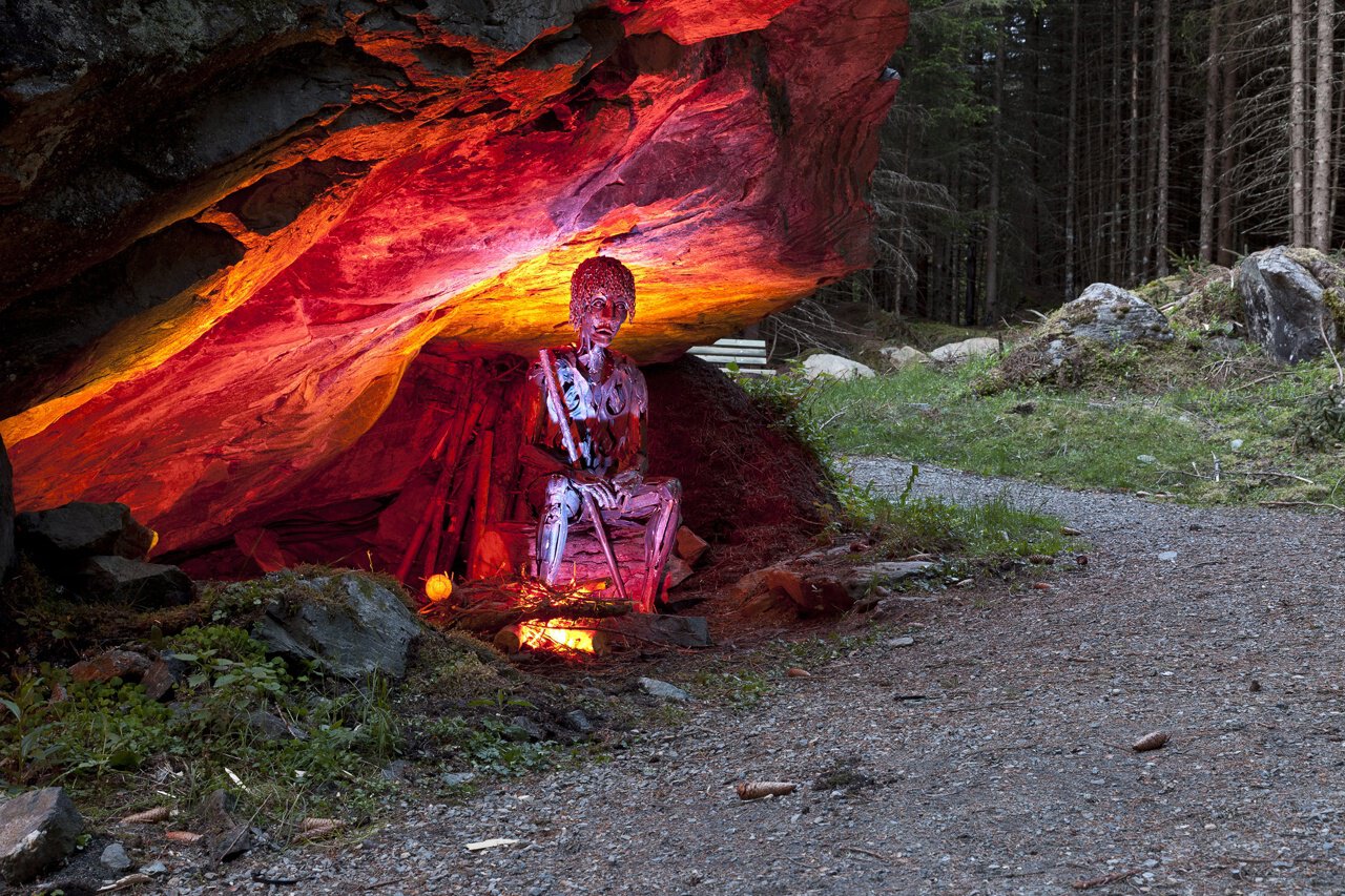
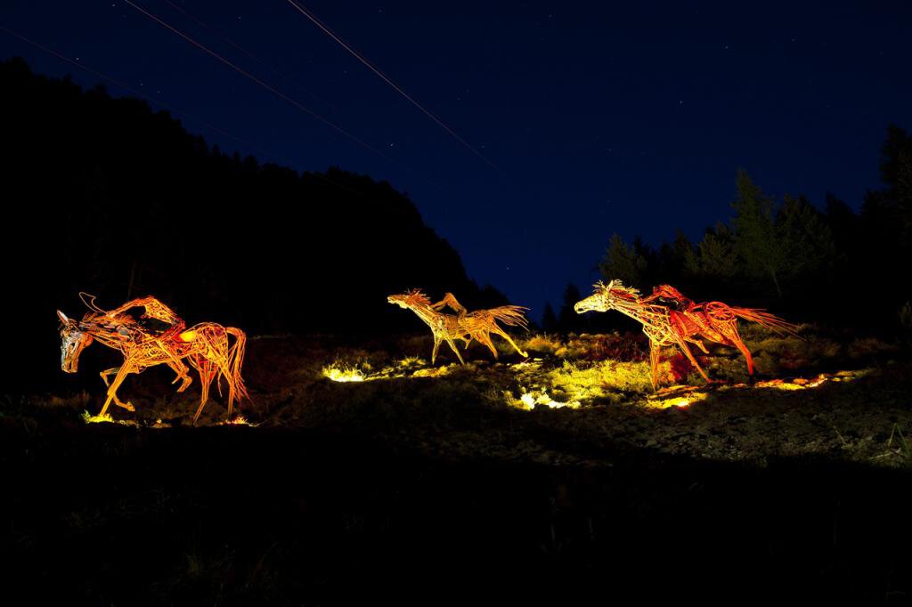
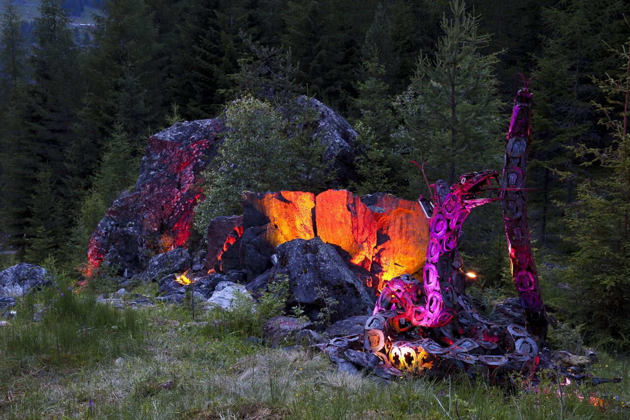
The descent can be made via the Legend Trail. The family-friendly forest path surprises with metal sculptures up to six meters high:
14 legends are recreated from scrap metal with life-sized and surprisingly lively figures. Plaques explain the respective legend, such as the fight of the giant, the wild Mandl, or the Angel's Wall.
Since the entire path runs through the forest, the hike is recommended both in high temperatures and in rainy weather.
Regions & Places
Mountain areas
Details
Characteristics
Way types
Safety guidelines
Easy hiking trail; suitable for beginners and walkers. Please observe the current weather report.
Additional information
More information about hiking in Ötztal can be found here.
Directions
The approximately 90-minute hike suitable also for families with children starts at the football field in Huben. Follow the signs towards Alpengasthof Feuerstein/Polles Alm.
After a few meters on the forest path, the path forks.
Variant 1 (which is mapped in the route): You stay on the forest path which runs with a gentle ascent until shortly before the hut. The last bit just before the hut is somewhat steeper.
Variant 2 (described here as the return path): A special kind of hiking trail is the Legend Trail. This walking path runs leisurely for about 3 km through the forest. Along the route, there are sculptures up to 6 meters high that depict 14 different legends from the Ötztal.
Arrival
Public transit
Travel comfortably and safely by train. The final stop or departure point is the ÖTZTAL train station. Afterwards, you can conveniently and quickly travel through the entire valley to your desired destination by public transportation or local taxi companies.
The current bus schedule is available at: http://fahrplan.vvt.at
Starting point
Getting there
The drive to ÖTZTAL
Travelling by car, visitors go through the Inn valley to the valley entrance and continue along Ötztal. In addition to the toll motorway, country roads can also be used. Your trip can be quickly and conveniently planned with the route planner. To the route planner: https://www.google.at/maps
Parking
The following parking options are available in Huben:
- Huben first entrance before Praxmarer carpentry – free of charge
- Funpark Huben
- Football field Huben
Current information
Midsummer-like hot
Equipment
wind-, rain- & sun protection, hat, possibly gloves, is for all hikes and tours necessary.