

Winter path Wellerbrücke - No. 403
Map & elevation profile
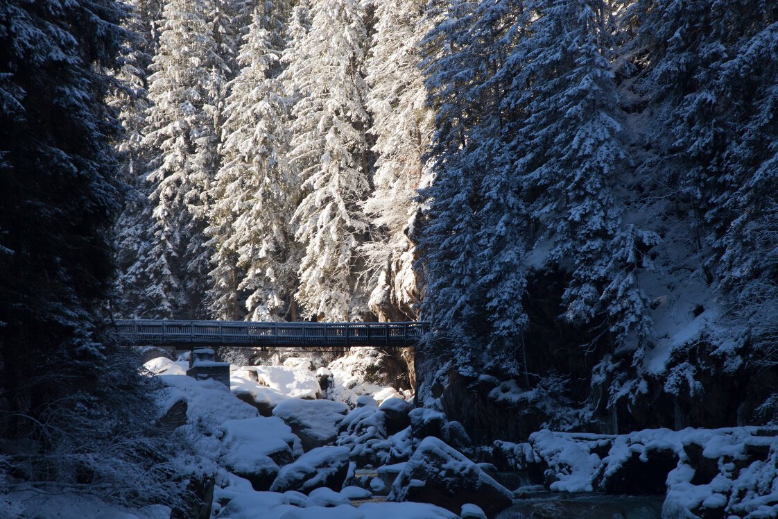
The Tour
A very comfortable, easy hike from Oetz to the idyllic Wellerbrücke.
The hike starts in the center of Oetz. From here, you walk to the Ötztaler Ache and follow it along a gently ascending path downhill until you reach the Wellerbrücke. Additionally, a platform allows an unobstructed view of the raging water.
Regions & Places
Mountain areas
Details
Characteristics
Way types
Safety guidelines
Please observe the current snow and avalanche report for the coming days: https://www.oetztal.com/de/winter.html & https://avalanche.report/albina-web/bulletin/2019-01-07?lang=de
Additional information
Recommended literature
Recommended maps
Kompass #043 | Ötztaler Alpen Ötztal, Pitztal | 1:50,000
Directions
A very comfortable, easy hike from Oetz to the idyllic Wellerbrücke.
The hike starts in the center of Oetz. From here, you walk to the Ötztaler Ache and follow it along a gently ascending path downhill until you reach the Wellerbrücke. Additionally, a platform allows an unobstructed view of the raging water.
Arrival
Public transit
Travel comfortably and safely by train to the Ötztal train station. The final stop or exit point is ÖTZTAL station. Then, you can conveniently and quickly travel by public bus or local taxi companies throughout the valley to your desired destination. The current bus schedule is available at: http://fahrplan.vvt.at
Starting point
Getting there
Driving into ÖTZTAL. Located in Tyrol, the ÖTZTAL branches southward as the longest side valley of the Eastern Alps. Travel by car takes visitors through the Inn valley to the valley entrance and continues along the Ötztal. In addition to toll motorways, regional roads are also usable. Your drive can be quickly and conveniently planned using the route planner: To the route planner: https://www.google.at/maps
Parking
The following parking options are available:
Oetz town center parking lot (fee required)
Rafting entry point parking lot (at the end of Oetz on the right side) (fee required)
Overnight parking during multi-day tours: Oetz town center parking lot, tickets available at the Oetz tourist office.
Acherkogelbahn parking lot (fee required)
Current information
Midsummer-like hot
The tour is within these protected areas.
Equipment
Appropriate equipment such as breathable and weather-appropriate outdoor clothing, wind, rain, snow, and sun protection, a hat and gloves, is required for all hikes and routes. Carrying a first aid kit, a mobile phone, and possibly a tour map, as well as sufficient provisions for tours without dining options, is necessary.