


Water strider Piburger See Oetz
Description
Oetz –> Wellerbrücke (Achstürze) –> Piburger See –> Seejöchl –> Piburg –> Oetz
Map & elevation profile
The Tour
Oetz –> Wellerbrücke (Achstürze) –> Piburger See –> Seejöchl –> Piburg –> Oetz
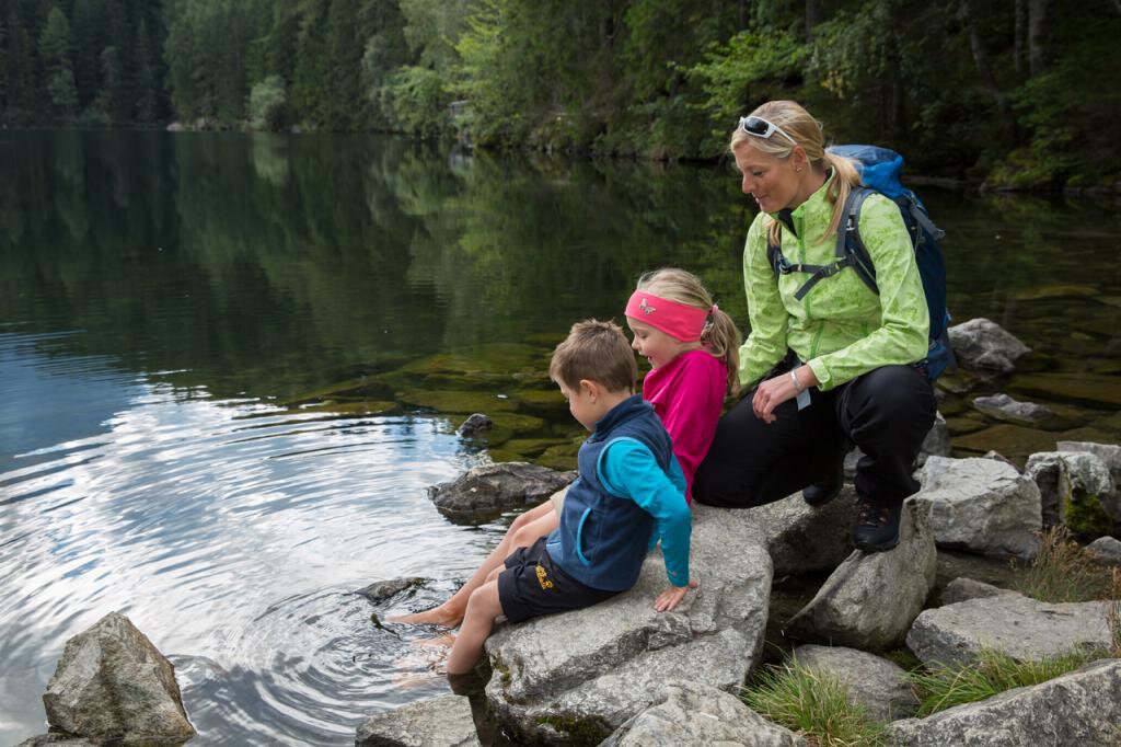
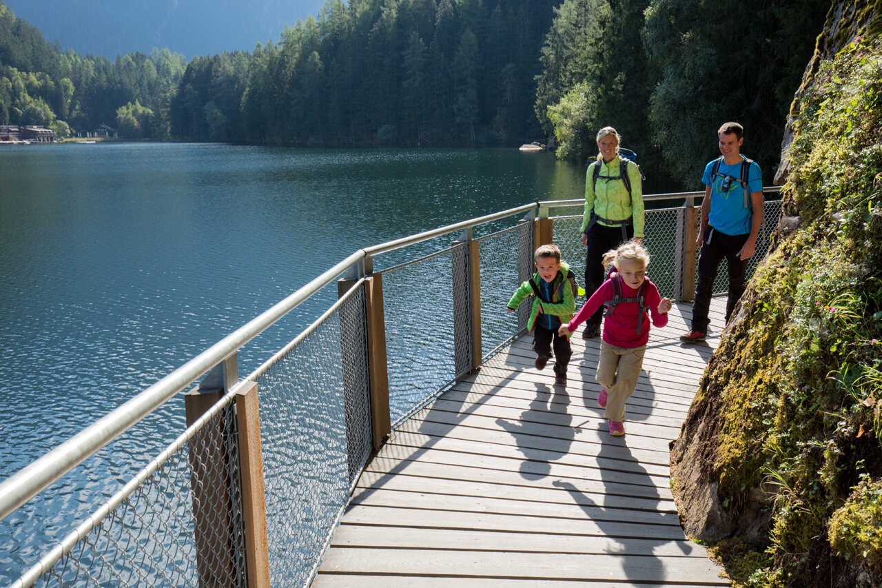
On this hike, you experience the wild water of the Ötztaler Ache in contrast to the calm water of the Piburger See.
From Oetz, you walk along the roaring waters of the Ötztaler Ache over a gravel path heading south. In a forested area, you reach the Wellerbrücke. Here, the view opens onto one of the most extreme wild water sports courses and a longtime venue of the extreme kayak world championship. On the other side, you follow the signposted hiking trail and later a forest road towards Piburger See. Suddenly the forest edges open and you look out at the picturesque lake surrounded by many myths.
Keeping left, you hike up to Seejöchl. The steep ascent is rewarded with a breathtaking view of the harmonious landscape. The circular path continues to Piburg and then back down and around the lake. Returning to the bathing facility, you walk left on the signposted path back to Oetz. On the descent, solitary benches or inns invite you to rest.
Regions & Places
Mountain areas
Details
Characteristics
Way types
Safety guidelines
Sure-footedness
No particular difficulties
Additional information
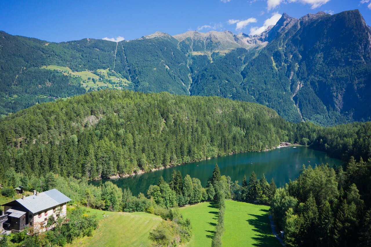
Piburger See
- The Piburger See is probably not only the best-protected lake in Tyrol (natural monument, landscape protection area, lake protection area) but also the best-studied lake.
- Almost 40% of the water inflow to the lake is underground.
- In the 19th century, the outflow was channeled underground, lowering the lake level by about 1.5 m.
- With up to 24°C, the warmest bathing lake in Tyrol.
WATER IN THE ÖTZTAL
Water, the defining element of the Ötztal.
The meltwater from glaciers melted by the sun feeds the meadows and the Ötztaler Ache, which runs through the 65 km long valley. The Ötztaler Ache's catchment area covers 893 km² with an altitude range between about 700 and 3,774 m. This glacial melt fills the population's water reservoir and ensures drinking water supply.
Glaciers store three quarters of all freshwater reserves and thus represent the largest natural water reservoirs in the world.
In 1770, advancing ice repeatedly dammed large lakes, which when they burst caused catastrophic floods throughout the Ötztal and even the Inn valley. The natural hazard prompted people increasingly to engage with their environment and promoted glacier research. The diversity of water in the Ötztal serves not only science. The Ötztal glaciers are also a recreational space for the population and guests, as these “ice wonders” additionally serve as hiking and especially skiing areas. Moreover, glacial melt has made possible action-packed leisure activities such as rafting, white-water rafting, and many more.
More info about hiking in the Ötztal: https://www.oetztal.com/wandern
Directions
On this hike, you experience the wild water of the Ötztaler Ache in contrast to the calm water of the Piburger See.
From Oetz, you walk along the roaring waters of the Ötztaler Ache over a gravel path heading south. In a forested area, you reach the Wellerbrücke. Here, the view opens onto one of the most extreme wild water sports courses and a longtime venue of the extreme kayak world championship. On the other side, you follow the signposted hiking trail and later a forest road towards Piburger See. Suddenly the forest edges open and you look out at the picturesque lake surrounded by many myths.
Keeping left, you hike up to Seejöchl. The steep ascent is rewarded with a breathtaking view of the harmonious landscape. The circular path continues to Piburg and then back down and around the lake. Returning to the bathing facility, you walk left on the signposted path back to Oetz. On the descent, solitary benches or inns invite you to rest.
Arrival
Public transit
Travel comfortably and safely by train to the Ötztal station. The final stop or exit point is the ÖTZTAL station. Afterwards, you can conveniently and quickly travel through the entire valley to your desired destination using public transit or local taxi companies! The current bus schedule is available at: http://fahrplan.vvt.at
Starting point
Getting there
Oetz is located in western Austria in the state of TIROL, in a southern side valley of the Inn Valley - the ÖTZTAL. For your arrival by car, plan the optimal route from your home location with the route planner online: https://www.google.at/maps
Parking
The following parking options are available in Oetz/Piburg:
- Acherkogelbahn parking lot (paid)
- Rafting entry point parking lot (at the end of Oetz on the right side) (paid)
- Oetz central parking lot (paid)
- Overnight parking for multi-day routes: Oetz central parking lot, tickets available at the Oetz information office.
- Piburg parking lot at Hotel Seerose, paid
Current information
Midsummer-like hot
The tour is within these protected areas.
Equipment
Wearing hiking gear such as breathable and weather-appropriate outdoor clothing, ankle-high hiking boots, wind, rain and sun protection, a hat and possibly gloves is recommended! It is also important to bring sufficient provisions as well as a first aid kit, a mobile phone and possibly a hiking map.
Standard hiking equipment