Stabele - Brunnenbergalm
Hiking Trail
· Gemeinde Sölden

Responsible for this content
Ötztal Verified partner
Hint
Explanation
Selected alternatives for you
SÖLDEN -> MOOSALM -> BRUNNENBERGALM
moderate
Distance 5.5 km
Duration2:00 h
Ascent595 m
Descent0 m
Highest point1,972 m
Lowest point1,360 m
The Brunnenberg is located on the quiet side of Sölden.
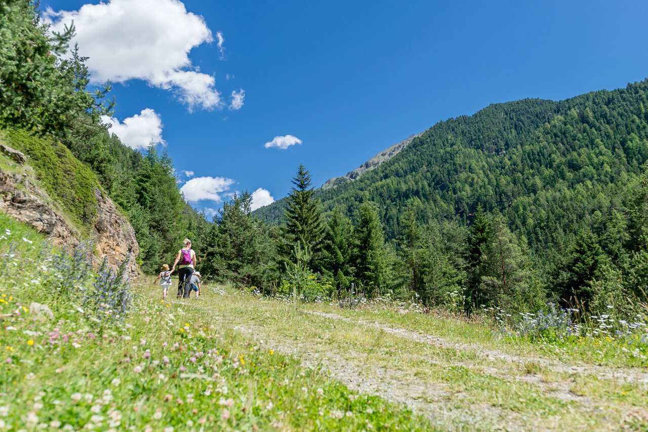
We recommend the Gaislachkoglbahn parking lot as a starting point. From there you walk towards the Camping Platz Sölden, cross the bridge and continue right up to the Moosalm.
Here you can enjoy the panoramic view over Sölden. The trail coninues slightly uphill on a forest road that leads through dense forest to the Brunnenbergalm. From the Brunnenberg you have a beautiful view of the ski mountain Gaislachkogl and down to the valley of Sölden.

Author
Roland Grüner
Update: March 26, 2024
Difficulty
moderate
Overall difficulty
moderate
Derived from the technical difficulty and the stamina requirements.
Experience
Landscape
Highest point
Brunnenbergalm, 1,972 m
Lowest point
Sölden, 1,360 m
Best time of year
Jan
Feb
Mar
Apr
May
Jun
Jul
Aug
Sep
Oct
Nov
Dec
Track types
Show elevation profileRest stops
MoosalmBrunnenberg Hut
Safety information
Moderate mountain trail; for sure-footed and experienced hikers. Good physical condition, mountain experience& mountain equipment (see notice equipment) necessary. Please pay attention to the current weather report:Tips and suggestions
More details about hiking In Ötztal: https://www.oetztal.com/wandernPublic transport
Travel safe and comfortable with the train to the Ötztal Bahnhof train station. Last stop and exit point is the train station Ötztal Bahnhof. Afterwards you can travel smoothly and quick with the public transport or our localtaxi companies through the valley to your desired destination. Please find the current bus timetable here:http://fahrplan.vvt.at
Directions
The car drive to the Ötztal valley. Situated in Tirol, the Ötztal valley set off in southerly direction and is the longest side valley in the Eastern Alps. The journey with the car leads you through the Inntal valley to the entrance of the valley and further on through the valley. Among the toll motorways you can also use the country roads. A route planner will show you the easiest and most convenient way: https://www.google.at/mapsParking
The following parking facilities are available in Sölden:- Parking lot Postplatz
- parking lot Stiegele
- stair parking
- Giggijochbahn + underground garage
- Gaislachkoglbahn + underground garage
- Parking Hochsölden
- parking garage Hochsölden 1. parking lot
All parking is free during the day.
Parking for several days (eg hike tour):
- Parkgarage Gaislachkoglbahn, Parkticket either online or directly at the cash desk of the Gaislachkoglbahn
Coordinates
DD
46.960258, 11.009181
DMS
46°57'36.9"N 11°00'33.1"E
UTM
32T 652860 5202707
w3w
///brambles.mercies.teaspoons
Get there by train, car, bike, or on foot!
Book recommendation by the author
Almzeit Brochure
Author’s map recommendations
Kompass #042 | Inneres Ötztal und Pitztal
Equipment
Appropriate equipment such as breathable suitable outdoor clothes for the weather, ankle-high walking boots, wind-, rain- & sun protection, hat, possibly gloves, is for all hikes and tours necessary. Please bring a first-aidbox, a mobile phone, a walking map and if there is no hut on the way a snack and enough to drink.map.
Difficulty
moderate
Overall difficulty
moderate
Derived from the technical difficulty and the stamina requirements.
Distance
5.5 km
Duration
2:00 h
Ascent
595 m
Highest point
1,972 m
Lowest point
1,360 m
Scenic
Refreshment stops available
Family-friendly
Linear route
Statistics
- Content
- Show images Hide images
Maps and trails
2 Waypoints
Nothing selected - click and drag in the elevation profile to zoom
km
Distance
Duration
Ascent
Descent
Elevation profile