

Snowshoe Trail Acherkogelblick 02
Description
ACHERKOGELBAHN -> Rotes Wandl -> Acherkogelblick Viewing Platform -> ACHERKOGELBAHN
Map & elevation profile
The Tour
ACHERKOGELBAHN -> Rotes Wandl -> Acherkogelblick Viewing Platform -> ACHERKOGELBAHN
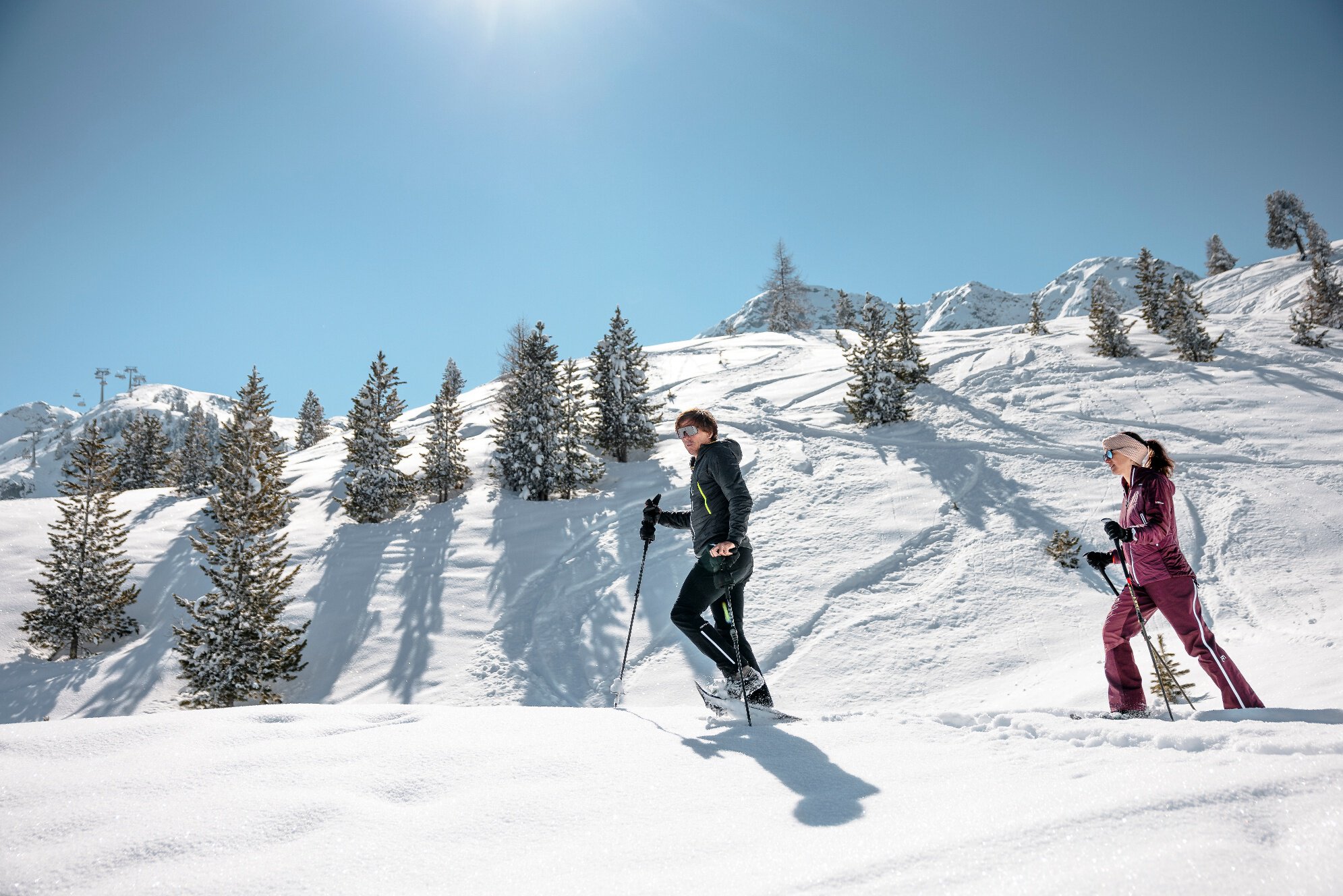
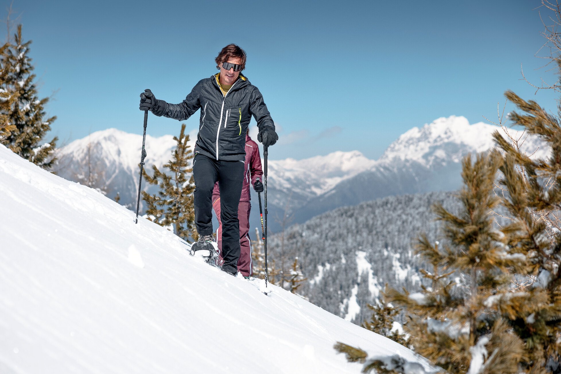
You take the Acherkogelbahn into the Hochoetz ski region. The beautiful, signposted snowshoe trail starts below the panoramic restaurant (2020 m) and leads off-piste to the Rotes Wandl, then gently downhill through the snow-covered winter forest to the Acherkogelblick viewing platform. The impressive view of the Acherkogel invites you to linger. On the way back, the kilometers covered must always be ascended slightly.
Very beautiful snowshoe trail in a great winter landscape, crowned by the chance to enjoy the impressive panorama on the viewing platform.
Regions & Places
Mountain areas
Details
Characteristics
Way types
Safety guidelines
Please note the current snow and avalanche report for the coming days: https://www.oetztal.com/en/winter.html & https://avalanche.report/albina-web/bulletin/2019-01-07?lang=en
Additional information
Recommended literature
Winter local information Oetz I available at Information Oetz
Recommended maps
Kompass #043 | Ötztal Alps Ötztal, Pitztal | 1:50,000
Directions
You take the Acherkogelbahn into the Hochoetz ski region. The beautiful, signposted snowshoe trail starts below the panoramic restaurant (2020 m) and leads off-piste to the Rotes Wandl, then gently downhill through the snow-covered winter forest to the Acherkogelblick viewing platform. The impressive view of the Acherkogel invites you to linger. On the way back, the kilometers covered must always be ascended slightly.
Arrival
Public transit
Travel comfortably and safely by train to Ötztal station. At the station, you will find public transport or local taxi companies that will be happy to take you to your desired destination! The current bus schedule is available at: http://fahrplan.vvt.at
Starting point
Getting there
Parking
The following parking options are available:
- Acherkogelbahn parking lot (paid)
- Rafting entry point parking lot (at the end of Oetz on the right side) (paid)
- Oetz center parking lot (paid)
- Overnight parking during multi-day tours: Oetz center parking lot, tickets are available at the Oetz information office.
Current information
Midsummer-like hot
Equipment
Appropriate equipment such as breathable and weather-appropriate outdoor clothing, wind, rain, snow, and sun protection, hat and gloves is required for all hikes and routes. Carrying a first aid kit, a mobile phone, and possibly a route map, as well as sufficient provisions for tours without places to stop, is necessary.