


Schönwieshütte - Obergurgl
Map & elevation profile
The Tour
OBERGURGL -> Zirbenwald -> Rotmooswasserfall -> SCHÖNWIESHÜTTE
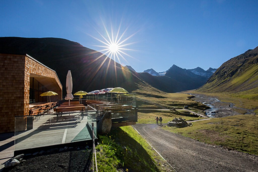
From Obergurgl center heading south, follow the promenade path at the end of the village to the Zirbenwald. From there continue on the promenade path to a vantage point (way cross and bench) opposite the Nasenwand. Now turn left and ascend pictorially through the 400-year-old Zirbenwald to a small hill. Now it goes lightly to moderately uphill on a good gravel path along the west slope of the Hohe Mut towards Rotmoostal and over the bridge to the serviced Schönwieshütte. From there a recommended short hike (1/4 hour) over grassy slopes uphill to the Schönwieskopf with a beautiful view down into the Gurgler Rotmoostal.
Regions & Places
Mountain areas
Details
Characteristics
Way types
Safety guidelines
Easy hiking route; suitable for beginners and walkers. Please pay attention to the current weather report at: https://www.oetztal.com/de/sommer.html.
Hiking difficulty
Additional information
More information about hiking in the Ötztal: https://www.oetztal.com/wandern
Directions
From Obergurgl center heading south, follow the promenade path at the end of the village to the Zirbenwald. From there continue on the promenade path to a vantage point (way cross and bench) opposite the Nasenwand. Now turn left and ascend pictorially through the 400-year-old Zirbenwald to a small hill. Now it goes lightly to moderately uphill on a good gravel path along the west slope of the Hohe Mut towards Rotmoostal and over the bridge to the serviced Schönwieshütte (from 01.07.23). From there a recommended short hike (1/4 hour) over grassy slopes uphill to the Schönwieskopf with a beautiful view down into the Gurgler Rotmoostal.
Arrival
Public transit
Travel comfortably and safely by train to Ötztal station. The terminus or exit point is ÖTZTAL station. Afterwards, travel conveniently and quickly by public transport or local taxi companies through the entire valley to your desired destination! The current bus timetable is available at: http://fahrplan.vvt.at
Starting point
Getting there
Obergurgl-Hochgurgl is located in the west of Austria in the state of TYROL, in a southern side valley of the Inn valley – the ÖTZTAL. For your arrival by car, plan the optimal travel route from your home location with the route planner online right away: https://www.google.at/maps
Parking
- Parking garage village center Obergurgl (go down right in front of the church), paid | € 2.00 first hour, for every additional 1/2 hour € 1.00 up until max. € 16.00 for 24 hours
- Parking garage village entrance – Festkoglbahn valley station, paid | € 6.00 from 8:00 am to 8:00 pm, € 10.00 from 8:00 pm to 8:00 am
- Parking lot Hochgurglbahn valley station, free – no overnight parking
- Parking lot Top Mountain Crosspoint, free
Current information
Significant warming
Southerly foehn, very warm
The tour is within these protected areas.
Equipment
Appropriate equipment such as breathable and weather-appropriate outdoor clothing, ankle-high hiking boots, wind, rain, and sun protection, a hat, and possibly gloves, is required for all hikes and routes. Carrying a first-aid kit, a mobile phone, and possibly a hiking map, as well as sufficient provisions for hikes without the option to stop at a hut, is necessary.