
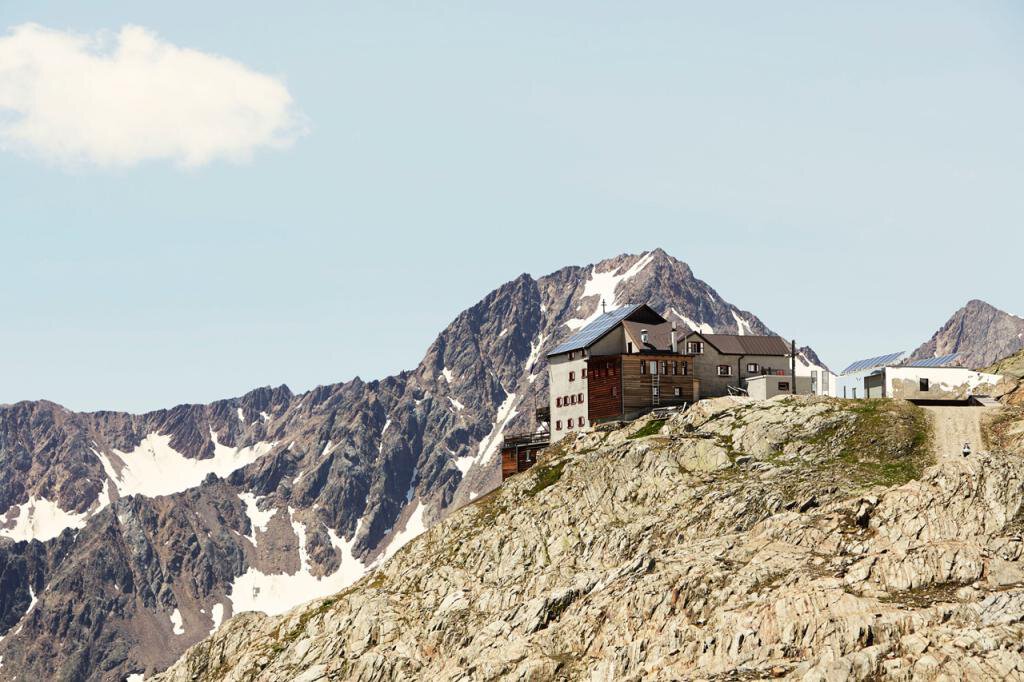
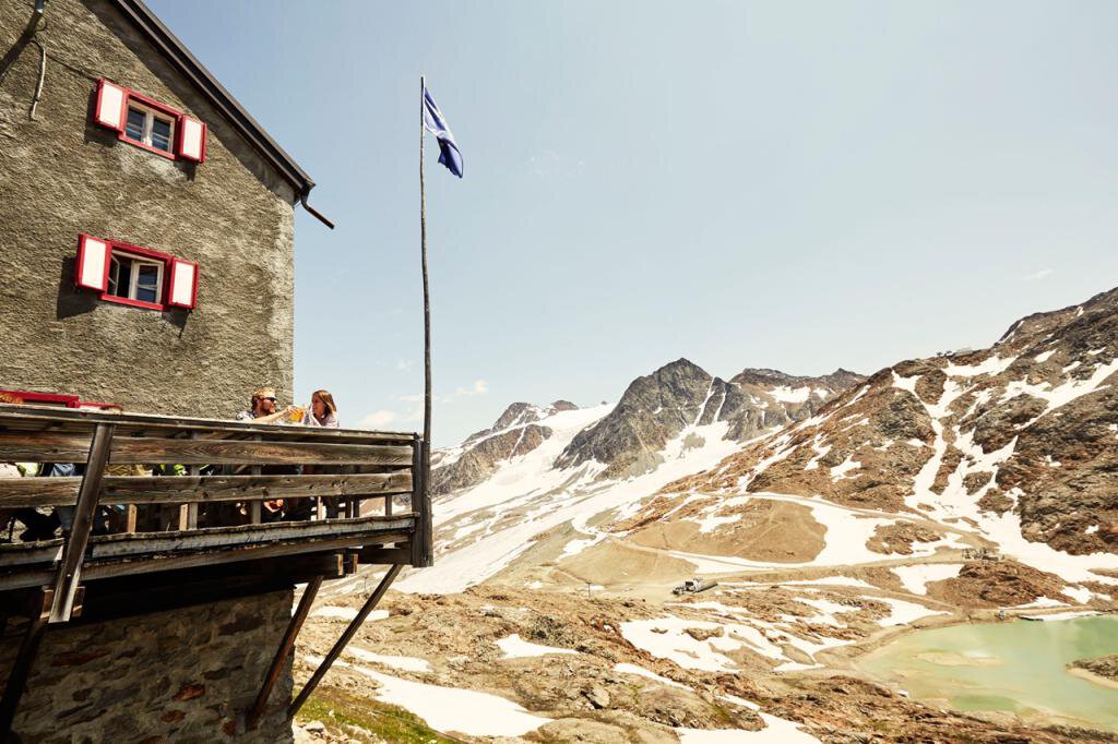


Schöne Aussicht
Map & elevation profile
The Tour
From Vent over the meadows and the suspension bridge to Rofen. From there continue to the material cable car of the Vernagthütte and further through the impressive Rofen Gorge on a path that first ascends moderately, then steeply to the Hochjoch Hospice.
From the hut, a steep path leads down to the iron bridge crossing the Hintereisbach. From there, ascend in several hairpin bends and then moderately above the Hochjoch Glacier to the Schöne Aussicht refuge.
Reservation of the hut sleeping places necessary!
Regions & Places
Mountain areas
Details
Characteristics
Way types
Safety guidelines
Additional information
More info about hiking in the Ötztal: https://www.oetztal.com/wandern
Recommended literature
Ötztal Hiking Book | Helga Marberger | Publisher: Tyrolia
Recommended maps
Kompass #042 | Inner Ötztal and Pitztal, Gurgler Tal, Venter Tal | 1:25,000
Kompass #43 | Ötztal Alps, Ötztal, Pitztal | 1:50,000
Freytag&Bernd WK 251 | Ötztal, Pitztal, Kaunertal, Wildspitze | 1:25,000
Kompass | Bike & hiking map Ötztal | 1:35,000
Directions
From Vent over the meadows and the suspension bridge to Rofen. From there continue to the material cable car of the Vernagthütte and further through the impressive Rofen Gorge on a path that first ascends moderately, then steeply to the Hochjoch Hospice.
From the hut, a steep path leads down to the iron bridge crossing the Hintereisbach. From there, ascend in several hairpin bends and then moderately above the Hochjoch Glacier to the Schöne Aussicht refuge.
Arrival
Public transit
Travel comfortably and safely by train to the Ötztal train station. The final stop or exit point is the ÖTZTAL station. Afterwards, travel conveniently and quickly with public bus services or local taxi companies throughout the valley to your desired destination! The current bus timetable is available at: http://fahrplan.vvt.at
Starting point
Getting there
The car ride to the ÖTZTAL. Located in Tyrol, the Ötztal branches off southwards as the longest side valley of the Eastern Alps. Traveling by car leads visitors via the Inn valley to the entrance of the valley and then along the Ötztal. In addition to the toll motorway, country roads can also be used. Your drive can be quickly and conveniently planned using the route planner: To the route planner: https://www.google.at/maps
Parking
In the mountaineering village Vent, the following parking options are available.
- In summer, in front of the village (parking meter, coins or EC card only) and at the valley station of the chairlift (at the ticket office of the cable cars)
- In winter, only at the valley station of the chairlift.
Cost: € 5.00 per day/per car
Current information
Midsummer-like hot
The tour is within these protected areas.
Equipment
Appropriate equipment such as breathable and weather-appropriate outdoor clothing, ankle-high hiking boots, wind, rain and sun protection, hat, possibly gloves, is required for all hikes and routes. It is necessary to carry a first aid kit, a mobile phone and possibly a hiking map, as well as sufficient provisions for hikes without the possibility of stopping for refreshment.