


Rear Tumpen Alm - Umhausen
Description
TUMPEN -> Parking lot Primary School -> Grube -> Crossroads -> Front Tumpen Alm -> REAR TUMPEN ALM
Map & elevation profile
The Tour
TUMPEN -> Parking lot Primary School -> Grube -> Crossroads -> Front Tumpen Alm -> REAR TUMPEN ALM
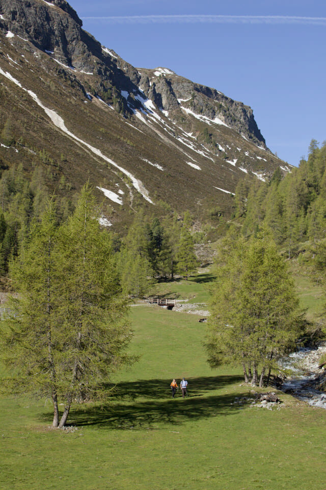
The start is in Tumpen at the parking lot by the primary school. From there, follow the road towards Grube – to the left, a forest path leads up past the Tumpen Waterfall. At the last crossroads, turn left towards the sidewalk or the Front Tumpen Alm. Follow the forest path past the Front Tumpen Alm to the Rear Tumpen Alm. The Alm is not managed! The highlight on this quiet and varied path is the Tumpen Waterfall. The Front Tumpen Alm offers a place to stop halfway for a break.
Regions & Places
Mountain areas
Details
Characteristics
Way types
Safety guidelines
Additional information
Recommended maps
Kompass hiking map | Scale: 1:35,000
Directions
The start is in Tumpen at the parking lot by the primary school. From there, follow the road towards Grube – to the left, a forest path leads up past the Tumpen Waterfall. At the last crossroads, turn left towards the sidewalk or the Front Tumpen Alm. Follow the forest path past the Front Tumpen Alm to the Rear Tumpen Alm. The Alm is not managed! The highlight on this quiet and varied path is the Tumpen Waterfall. The Front Tumpen Alm offers a place to stop halfway for a break.
Arrival
Public transit
Travel comfortably and safely by train to the Ötztal train station. The final stop or exit point is ÖTZTAL station. Afterwards, you can quickly and conveniently continue with public transport or local taxi companies through the entire valley to your desired destination! The current bus schedule is available at: http://fahrplan.vvt.at
Starting point
Getting there
The car trip to ÖTZTAL. Located in Tyrol, the Ötztal branches off southwards as the longest side valley of the Eastern Alps. Car travellers reach the valley via the Inn Valley to the valley entrance and continue along the Ötztal. Besides the toll motorway, country roads can also be used. Using the route planner, you can quickly and conveniently determine your trip.
Route planner: https://www.google.at/maps
Parking
In Tumpen, the following parking options are available to you:
- Parking lot Primary School Tumpen | free of charge
Current information
Midsummer-like hot
Equipment
Appropriate equipment such as breathable and weather-appropriate outdoor clothing, ankle-high hiking boots, wind, rain and sun protection, hat, and possibly gloves are required for all hikes and routes. It is necessary to carry a first aid kit, a mobile phone, and possibly a hiking map, as well as sufficient provisions for hikes without a possibility to stop for food.