")


OHN LINE (6007)
Description
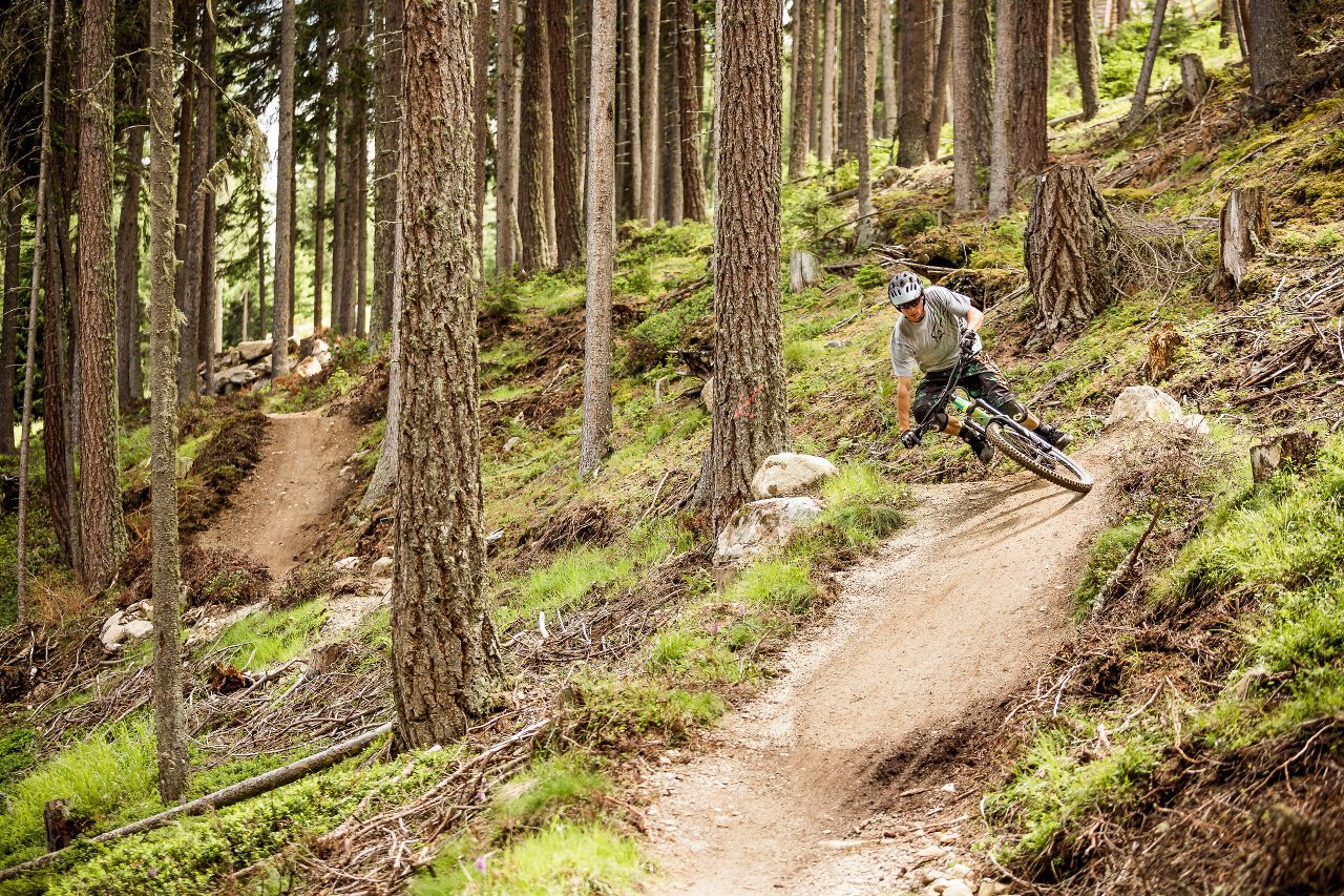
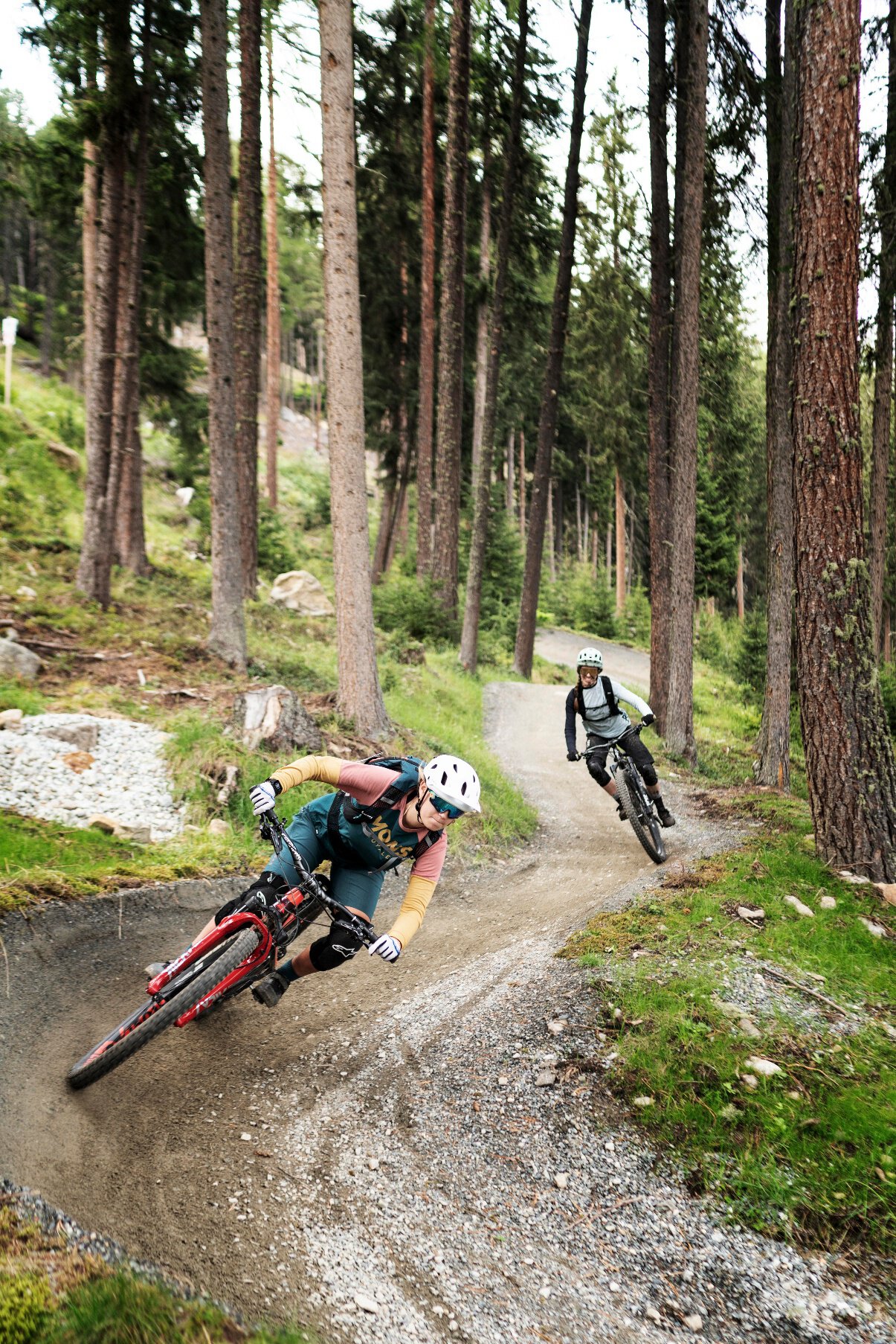
The playful blue OHN LINE winds through the forests of the BIKE REPUBLIC SÖLDEN. 3.7 km of finest flow with rhythmic waves and versatile wooden constructions.
Map & elevation profile
The Tour
The playful blue OHN LINE winds through the forests of the BIKE REPUBLIC SÖLDEN. 3.7 km of finest flow with rhythmic waves and versatile wooden constructions.
[ɔhn̩] "Ohn" the h is audibly pronounced – stands for "down" – and the OHN LINE also leads almost all the way down to the valley. However, not as steep as playful. The continuation of the EEBME LINE makes the most of the varied terrain: in the long sections it goes extremely flowy over rollers and flat berms before wooden structures follow in the lower section. The diverse OHN is celebrated by many citizens as their favorite, but the BIKE REPUBLIC naturally loves all of its babies equally.
The OHN is a ride of the finest kind – for ambitious riders as well as trail novices. The route flows into the lowest section of the BROATE LINE or the Schteckler Trail, which lead straight back to the Pumptrack ROLLIN. There are some rest opportunities in between.
It is also part of the 12.5 km long Long Line Rotkogl, which runs from the Langeggbahn mountain station (2,666 m) down to the valley station of the Gaislachkoglbahn.
Back in the valley, you can not only clean your bike and do a few more rounds on the pump track, but also get excellent catering (service).
Regions & Places
Mountain areas
Details
Characteristics
Way types
Safety guidelines
The OHN LINE is a blue line that is also well suited for trail beginners. Approach the varied route in a well-measured way.
In the BIKE REPUBLIC SÖLDEN, it's all about the shared fun of bike sport – no matter what riding level you have. Be considerate of each other and support each other. And behave just as respectfully towards all other people on the mountain and in the valley – and towards nature.
–> Stay on the paved and signposted paths. Do not ride over open meadows!
–> Avoid blocking the rear wheel and thus help preserve the paths.
–> Be considerate of animals & close the grazing gates. There can always be cows standing on the trails and lines. Ride accordingly carefully and keep distance!
Single trail difficulty
Additional information
More info about biking & cycling in the Ötztal: https://www.oetztal.com/biken
More info about probably the flowiest nation of the Alps, the BIKE REPUBLIC SÖLDEN: https://bikerepublic.soelden.com
And more videos here: https://www.youtube.com/c/BikeRepublicSöldenSoeldenSolden
Directions
You keep to right at the middle station of Gaislachkogl Mountain Gondola, after about 150 meters you reach the access to EEBME LINE (6005). Follow this flowy route to its end, then take a short transfer route straight to the start of OHN LINE (6007). OHN LINE joins TEÄRE LINE (6003) and Broate Line (6027) after about 4 km at the height of "Stiegele" area.
Arrival
Public transit
Arrival by train
Take the train easily to Ötztal Bahnhof at the valley entrance. A local bus leaves directly from the station square towards Obergurgl. The bus ride to Sölden takes about 1 - 1.5 hours. In the designated bike line buses, bike transport (including eMTBs) is free with a valid bus ticket.
You can find all important information about bus schedules, connections, and taxi companies here
Starting point
Getting there
WHERE IS SÖLDEN?
Sölden is located in western Austria in the federal state of TIROL, in a southern side valley of the Inn valley – the ÖTZTAL.
Arrival from the west:
from Vorarlberg to Tyrol via the Arlberg pass or through the Arlberg tunnel (S 16) - Landeck - Autobahn A 12 towards Innsbruck - exit Ötztal after Roppener Tunnel - B 186 (35 km) to Sölden
From the north:
- Bad Tölz - Achen pass - B 181 - Jenbach - A 12 Innsbruck direction Bregenz - exit Ötztal - B 186 (35 km) to Sölden
- Pfronten - Reutte - Fern pass - Imst - A 12 direction Innsbruck - exit Ötztal after Roppener Tunnel or B 171 Tiroler Straße to Ötztal (vignette-free) - B 186 (35 km) to Sölden
- Garmisch Partenkirchen - Ehrwald - Lermoos - Fern pass - Imst - A 12 direction Innsbruck - exit Ötztal after Roppener Tunnel or B 171 Tiroler Straße to Ötztal (vignette-free) - B 186 (35 km) to Sölden
- Garmisch Partenkirchen - Mittenwald - Scharnitz - Seefeld in Tirol - Telfs - A 12 direction Bregenz - exit Ötztal or B 171 Tiroler Straße to Ötztal (vignette-free) - B186 (35 km) to Sölden
From the east:
from Munich or Salzburg on the A 93 to Kufstein, then on the A 12 direction Bregenz, via Innsbruck to exit Ötztal, then continue on B 186 (35 km) to Sölden
From the south:
coming from Bolzano towards Brenner (toll road) - Brenner Autobahn via toll station Schönberg towards Innsbruck - from Innsbruck on A 12 direction Bregenz to Ötztal approach - continue on B 186 (35 km) to Sölden
Parking
At the valley station of the Gaislachkoglbahn and the Giggijochbahn, there are sufficient parking spaces available, and parking garages are also available.
Parking spaces are subject to a fee.
Paid overnight parking of cars is possible in the Gaislachkogl parking garage:
more information about overnight parking
Please respect that wild camping is prohibited!
Equipment
Well equipped rules! We recommend wearing MTB protective gear (helmet, protectors for knees, elbows, back, etc.) on all lines, trails, enduro tracks, and mountain bike routes of BIKE REPUBLIC SÖLDEN. All routes are exclusively intended for use with mountain bikes that meet today's quality standards.