


Ötztal Trek Route 4
Description
STAGES 13 – 17
Similaunhütte (3,017 m) – Hochjoch-Hospiz (2,412 m) – Brandenburger Haus (3,274 m) – Vernagthütte (2,755 m) – Breslauer Hütte (2,844 m) – Restaurant Tiefenbach (2,789 m) – Rettenbachjoch (2,990 m) – Braunschweiger Hütte (2,758 m)
Map & elevation profile
The Tour
STAGES 13 – 17
Similaunhütte (3,017 m) – Hochjoch-Hospiz (2,412 m) – Brandenburger Haus (3,274 m) – Vernagthütte (2,755 m) – Breslauer Hütte (2,844 m) – Restaurant Tiefenbach (2,789 m) – Rettenbachjoch (2,990 m) – Braunschweiger Hütte (2,758 m)
ON ÖTZI'S TRACKS
Elevation gain: 2,500 m ascent; 2,850 m descent
Distance: 40.5 km
One of the most popular mountain regions is probably the glacier world around Vent in the Ötztal. On Route 4, we follow Ötzi's tracks; of course, alpine experience and glacier travel with all safety precautions is absolutely necessary here.
Regions & Places
Mountain areas
Details
Characteristics
Way types
Safety guidelines
For those free from vertigo, sure-footed, and with high alpine experience; excellent physical condition, comprehensive mountain experience, alpine climbing equipment, safety and orientation tools, and good weather conditions recommended. Please note the current weather report.
Hiking difficulty
Additional information
Access – from Vent through the Nieder valley to the Martin-Busch hut and further to the Similaunhütte (approx. 4.5 h ascent)
More info about hiking in the Ötztal: www.oetztal.com/wandern
Recommended maps
Kompass hiking map (available at the Ötztal Tourism information offices)
Directions
Stage 13:
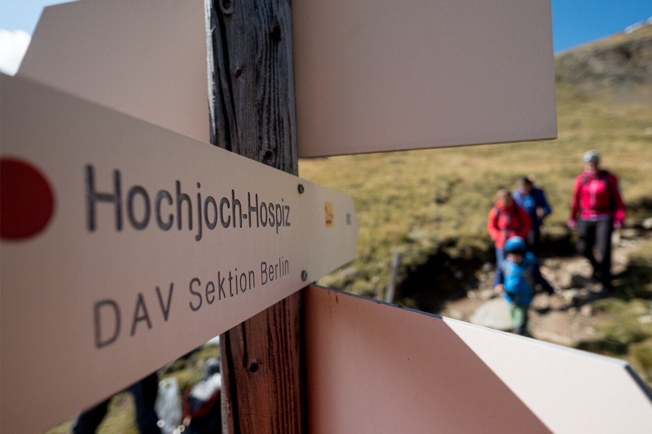
First, it goes upwards from the hut over a wide ridge until the ridge transforms into a steep block edge. Fixed ropes provide help in this passage until the terrain becomes flatter again in the last section to the Tisenjoch on the South Tyrolean side. The site where the Ice Man Ötzi was found here at the Tisenjoch is the highlight of the stage. Afterwards, we climb another 100 meters in altitude to the Hauslabjoch. We enter the Hochjochferner and keep to the right edge going north downhill. At 3,000 m altitude, the glacier is left, and at 2,950 m the route merges into the trail coming down from the Seikogel. Then we continue down the steep slope before the trail zigzags down into the Rofental. At 2,500 m, you cross the Hochjochbach and again descend in zigzags on steeper terrain down to the stream from the Hintereisferner. Another 100 challenging vertical meters must be mastered to reach the Hochjoch-Hospiz.
Stage 14:
First, you hike behind the hut in zigzags up the steep grassy slope. The path becomes steeper and we can already see our target. Majestically, the Brandenburger Haus towers at 3,274 m altitude on a rock above the Kesselwandferner. Up to about 3,000 m altitude, you have followed the Deloretteweg and now enter the crevassed glacier. The route is marked with visible poles. Roping up is, however, an essential requirement. The passage through the eternal ice towards west or northwest takes about an hour. In the final section of the route, it goes through block debris the last meters up the rocks to the Brandenburger Haus. The Weißkugel, perhaps the most beautiful mountain in Tyrol, is one of the countless visual highlights.
Stage 15:
We hike down from the Brandenburger Haus about 50 meters down through block debris onto the Kesselwandferner. Then we cross the glacier in a northeast direction to the Upper Guslarjoch. Less than 150 meters separate us from the 3,497 m high Fluchtkogel at the Upper Guslarjoch, the summit ascent of the fabulous viewpoint mountain is a must. From the pass, you climb up at the right edge of the glacier slope to the summit. Then back to the Upper Guslarjoch and from there descend in relatively steep terrain to the Guslarferner. It now goes flat over the first glacier floor until you have to overcome a terrain hump (particular crevasse danger here). After another steep slope, we then descend southeast. Finally, a trail leads down through moraine terrain or directly on the moraine ridge to the Vernagthütte.
Stage 16:
You descend the slope in front of the hut and then descend on the left side into the valley of the Vernagtbach. From here, a magnificent view opens to the Great Vernagtferner with the Hochvernagtspitze in the north or northwest. We cross the Vernagtbach and go up on the opposite side to the flat floors at Platteiberg. From Platteiberg onward, the tour runs only over the Rofental. You then cross the Platteikar and shortly afterward the trail leads through the Mitterkar. Directly above the Mitterkar rises the Ötztaler Wildspitze, which presents an unusually rocky face. At the mountain hut, it’s time to enjoy the view: Opposite rises the Kreuzspitze, among others; in the southwest, the Hochjochferner and the beautifully shaped Weißkugel are visible.
Stage 17:
We descend on a trail — the route leads past the foothills of the Rofenkars. A little below, you turn left to the new high trail, which runs outward over the Ventertal to merge into the original panorama trail between Vent and the Tiefenbachferner. The trail then descends further before ascending again and continuing above the Ventertal to the Restaurant Tiefenbach at the Tiefenbach glacier. At Restaurant Tiefenbach, you hike left up the ski slope before the road tunnel to the Seiter Jöchl (follow the Seiterjöchlbahn – chairlift). From the Jöchl, descend north to the Rettenbachferner (crampons necessary)! We go left around the rock spur, keep northwest, and cross on the mountain side of the glacier break to the Rettenbachjoch with the lift stations. From the pass, it goes down and finally to the Braunschweiger Hütte.
Variant:
By bus from Restaurant Tiefenbach to the valley station at Rettenbachferner and then on foot up to the uppermost parking lot of the glacier road; from there up to the Pitztaler Jöchl (2,996 m) – the last meters over a crevasse-free glacier field (possibly crampons); then easily down to the Braunschweiger Hütte; approx. 1.75 h from the valley station Rettenbachferner. If the Pitztaler Jöchl is closed: from the uppermost parking lot to Rettenbachjoch (the last meters easily on the glacier); approx. 1.75 h from the valley station to the hut.
Arrival
Public transit
Travel comfortably and safely by train to the Ötztal train station. The final stop or exit point is ÖTZTAL station. Afterwards, you travel conveniently and quickly by public transport or local taxis through the entire valley to your desired destination.
The current bus schedule is available at: http://fahrplan.vvt.at
Starting point
Getting there
The car trip into the ÖTZTAL. Located in Tyrol, the ÖTZTAL branches off to the south as the longest side valley of the Eastern Alps. The car journey leads travelers over the Inn valley to the valley entrance and further along the Ötztal. In addition to the toll motorway, country roads can also be used. With the route planner, your trip can be quickly and conveniently planned: To the route planner: https://www.google.at/maps
Parking
In Vent, the following parking options are available:
- at the entrance to Vent | paid | multi-day tickets possible
- valley station of the chairlift | paid | multi-day tickets possible
Current information
Midsummer-like hot
The tour is within these protected areas.
Equipment
Appropriate equipment such as breathable and weather-adapted outdoor clothing is required for all hikes and routes. Carrying a first aid kit, a mobile phone, and possibly a hiking map is necessary, as well as sufficient provisions for hikes without the possibility to stop for refreshments.