

Hiking Trail
Obergurgl - Sahne Stüberl
Gurgl
Top
Medium
Key facts
1:45 h
Duration
6.24 km
Length
36 m
Ascent
290 m
Descent
1,911 m
Max. altitude
1,672 m
Min. altitude
Best Season
Jan
Feb
Mar
Apr
May
Jun
Jul
Aug
Sep
Oct
Nov
Dec
Map & elevation profile
The Tour
OBERGURGL -> Piller See -> SAHNE STÜBERL
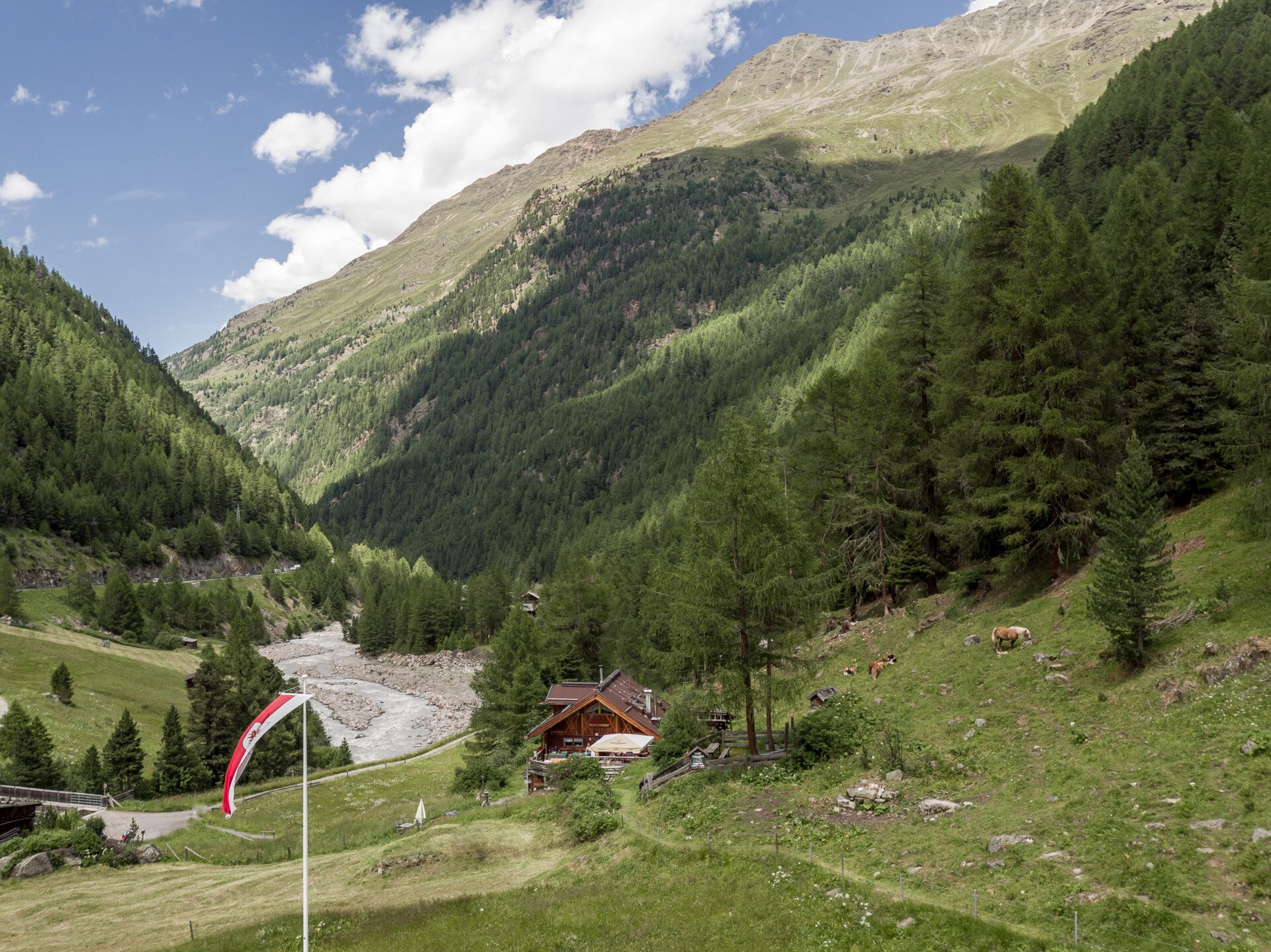
From the Festkoglbahn over the Ferwall bridge, gently descending along the alpine rose slopes to the hamlet of Königsrain. Just before, cross the street and take the path down to the Ötztaler Ache, continue over the Königsbach and to the old mill. Ascending to the right, cross the state road and go up opposite to the old country house. The shady, fairly level forest path leads above the districts Angern and Pill on the right side of the valley to the romantic Pillersee. he path continues over the Hohe Brücke bridge to the other side of the Gurgler Ache river. Ascend to the left along the galleries until you reach a descent via the galleries. Cross the Gurgler Ache again via a bridge, and soon the Sahne Stüberl will be visible.
Regions & Places
Austria (Country)
Tyrol (Province)
Bezirk Imst (District)
Ötztal (Tourism area)
Gurgl (Tourism area)
Gemeinde Sölden (Commune)
Mountain areas
Alps (Mountain area)
Ötztal Alps (Mountain area)
Modified at 13.07.2026 · Created at 09.07.2026
Details
Characteristics
Linear route
Refreshment stops available
Family-friendly
Dog-friendly
Way types
Safety guidelines
Moderately difficult mountain path; suitable for sure-footed and experienced mountain hikers.
Good physical condition, mountain experience and mountain equipment (see under Equipment) necessary. Please check the current weather report at: https://www.oetztal.com/de/sommer.html
Hiking difficulty
Easy hiking path - wide, continuously visible path. There is no danger of falling assuming normal behavior.
Additional information
More information about hiking in the Ötztal: https://www.oetztal.com/wandern
Directions
From the Festkoglbahn over the Ferwall bridge, gently descending along the alpine rose slopes to the hamlet of Königsrain. Just before, cross the street and take the path down to the Ötztaler Ache, continue over the Königsbach and to the old mill. Ascending to the right, cross the state road and go up opposite to the old country house. The shady, fairly level forest path leads above the districts Angern and Pill on the right side of the valley to the romantic Pillersee. he path continues over the Hohe Brücke bridge to the other side of the Gurgler Ache river. Ascend to the left along the galleries until you reach a descent via the galleries. Cross the Gurgler Ache again via a bridge, and soon the Sahne Stüberl will be visible.
Arrival
Public transit
Travel comfortably and safely by train to the Ötztal train station. The final stop or exit point is the ÖTZTAL station. Afterwards, you can conveniently and quickly travel with public transport or local taxi companies throughout the valley to your desired destination.
The current bus schedule is available at: http://fahrplan.vvt.at
Starting point
Obergurgl
Getting there
Driving to the ÖTZTAL. Located in Tyrol, the ÖTZTAL branches off to the south as the longest side valley of the Eastern Alps. Traveling by car takes visitors over the Inn valley to the valley entrance and further along the Ötztal. Besides the toll motorway, country roads can also be used. Your trip can be quickly and conveniently planned with the route planner: To the route planner: https://www.google.at/maps.
Parking
The following parking options are available in Gurgl:
- Parking garage village center Obergurgl (go down right in front of the church), paid | € 2.00 first hour, for every additional 1/2 hour € 1.00 up until max. € 16.00 for 24 hours
- Parking garage village entrance – Festkoglbahn valley station, paid | € 6.00 from 8:00 am to 8:00 pm, € 10.00 from 8:00 pm to 8:00 am
- Parking lot Hochgurglbahn valley station, free – no overnight parking
- Parking lot Top Mountain Crosspoint, free
Current information
Thursday, 08.10.
Golden October weather
Bright sunshine
Bright sunshine
Morning
8 °C
50%
Rainfall risk
Afternoon
11 °C
90%
Rainfall risk
Friday, 09.10.
Remaining clouds are increasingly
making way for the sun
making way for the sun
Morning
1 °C
20%
Rainfall risk
Afternoon
11 °C
0%
Rainfall risk
The tour is within these protected areas.
Naturpark Ötztal (Protected area)
Ötztaler Alpen (Protected area)
Ruhegebiet Ötztaler Alpen (Protected area)
Equipment
Appropriate equipment such as breathable and weather-appropriate outdoor clothing, ankle-high hiking boots, wind, rain and sun protection, a hat, and possibly gloves, is required for all hikes and routes. It is necessary to carry a first-aid kit, a mobile phone, and possibly a hiking map, as well as sufficient provisions for hikes without catering options.