


 - Roland Grüner")


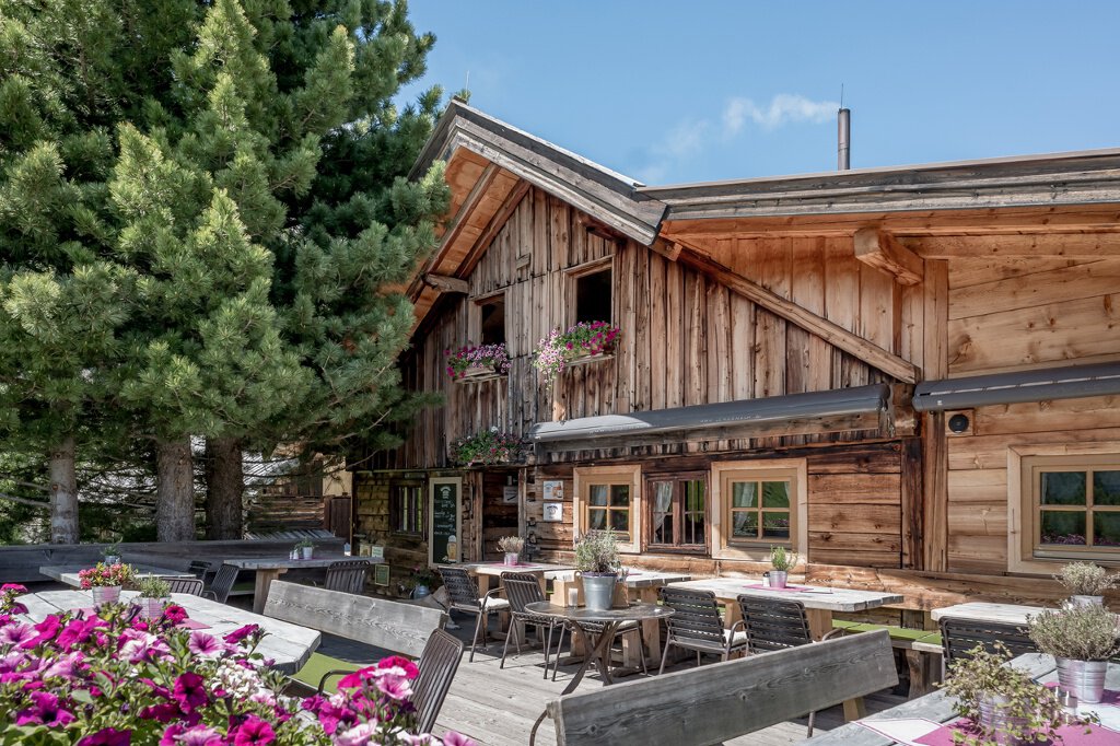
Lenzenalm
Map & elevation profile
The Tour
ZWIESELSTEIN BRIDGE/GURGLER ACHE -> LENZENALM
From Zwieselstein Bridge/Gurgler Ache over wooden bridge towards the church, ascending through sparse forest to Gurgler Street. Continue along the hiking trail to the Lenzenalm junction. Over a wide ascending forest road to the alpine hut. Or continue along the street to the next marker, then the narrow moderately to steeply ascending footpath to the alpine hut.
Regions & Places
Mountain areas
Details
Characteristics
Way types
Safety guidelines
For red mountain trails: medium-difficulty mountain path; suitable for sure-footed and experienced mountain hikers; good physical fitness, mountain experience, and mountaineering equipment (see equipment) required.
Please observe the current weather report at: https://www.oetztal.com/de/sommer.html
Additional information
More info about hiking in the Ötztal: https://www.oetztal.com/wandern
Recommended maps
Kompass #042 | Inner Ötztal and Pitztal, Gurgler Valley, Venter Valley | 1:25,000
Directions
From Zwieselstein Bridge/Gurgler Ache over wooden bridge towards the church, ascending through sparse forest to Gurgler Street. Continue along the hiking trail to the Lenzenalm junction. Over a wide ascending forest road to the alpine hut. Or continue along the street to the next marker, then the narrow moderately to steeply ascending footpath to the alpine hut.
Arrival
Public transit
Travel comfortably and safely by train to Ötztal station. The final stop or point to get off is ÖTZTAL station. Then you can travel conveniently and quickly with public transport or local taxi services through the entire valley to your desired destination. The current bus schedule is available at: http://fahrplan.vvt.at
Starting point
Getting there
Driving into the ÖTZTAL. Located in Tyrol, the ÖTZTAL branches off southwards as the longest side valley of the Eastern Alps. Traveling by car takes visitors through the Inn Valley to the valley entrance and further along the Ötztal. In addition to the toll motorway, country roads can also be used. Your route can be quickly and conveniently planned using the route planner: To the route planner: https://www.google.at/maps
Parking
The following parking options are available in Sölden:
- Postplatz parking lot
- Stiegele parking lot
- Step parking lot
- Giggijochbahn + underground garage
- Gaislachkoglbahn + underground garage
- Hochsölden parking lot
- Hochsölden parking garage 1st deck
The parking lots are subject to charges.
For parking multiple days (e.g., hut tour):
- Gaislachkoglbahn parking garage, parking ticket either online or directly at the Gaislachkoglbahn ticket office
Current information
The tour is within these protected areas.
Equipment
Appropriate equipment such as breathable and weather-appropriate outdoor clothing, ankle-high hiking shoes, wind, rain, and sun protection, a cap, possibly gloves, is required for all hikes and routes. Carrying a first aid kit, a mobile phone, and possibly a hiking map, as well as sufficient provisions on hikes without dining options, is necessary.