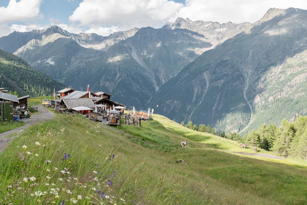
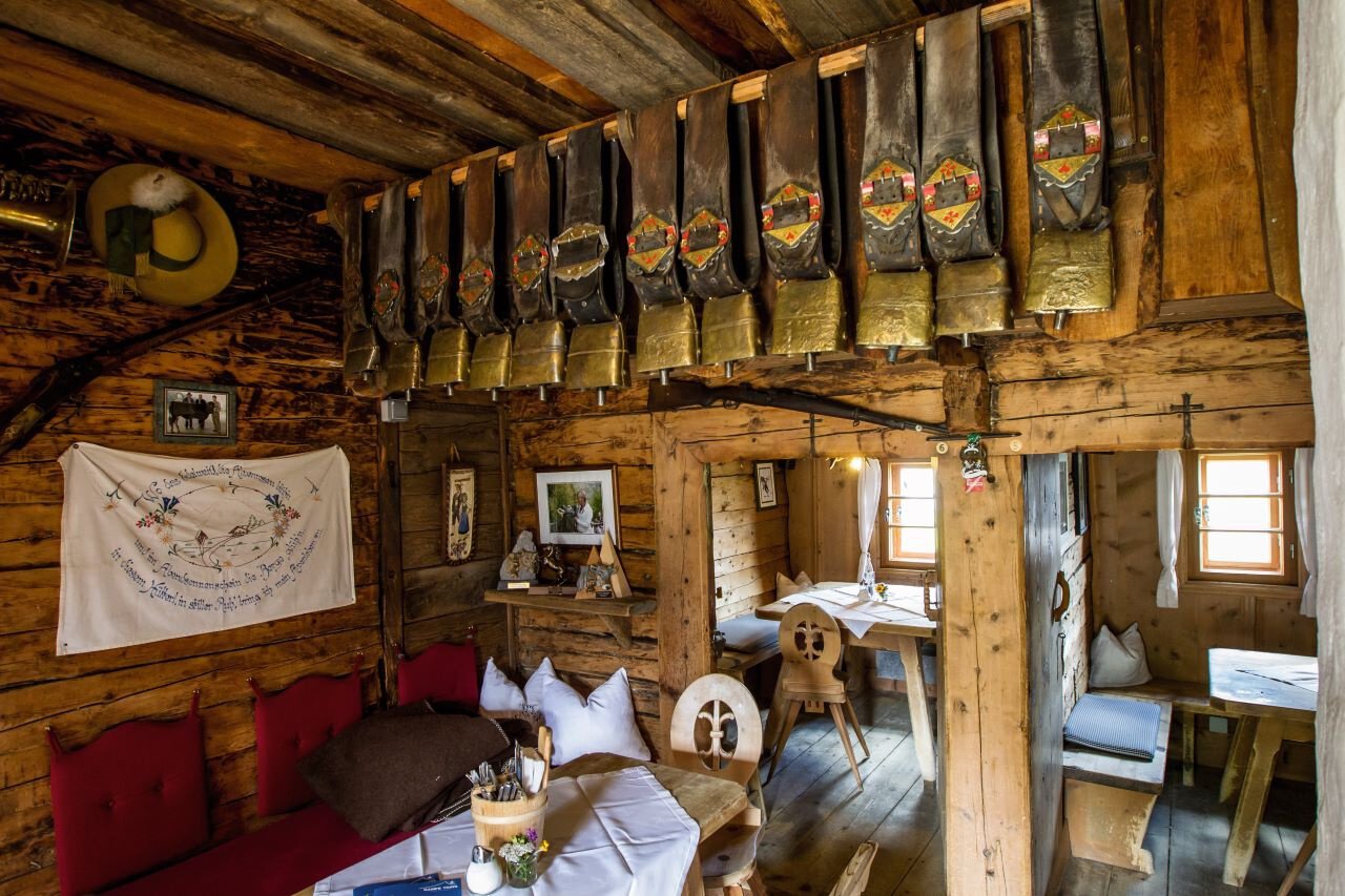
Hiking Trail

Gampe Thaya

Gemeinde Sölden
Top
Medium
Key facts
1:45 h Duration
2.6 km Length
623 m Ascent
20 m Descent
2,000 m Max. altitude
1,362 m Min. altitude
Stamina
Landscape
Quality of Experience
Best Season
Jan Feb Mar Apr May Jun Jul Aug Sep Oct Nov Dec

Description

SÖLDEN -> GAMPE THAYA -> SÖLDEN

Map & elevation profile

SÖLDEN -> GAMPE THAYA -> SÖLDEN
From Sölden you start walking past the church to the hamlet of Plödern. Further uphill through partly dense forest. The steeper forest path requires a good level of fitness. When you arrive at the Hochsölder Straße, you continue on the field path through the alpine meadows to Gampe Thaya.

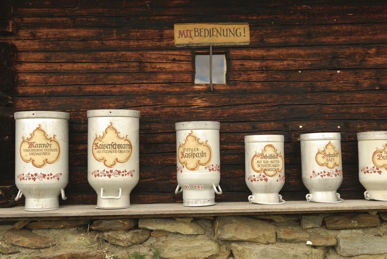
Feast, enjoy, switch off. That is the motto when you visit the Gampe Thaya. If you enjoy your time in the mountains, then why not stay. This is unique in the Tyrolean Ötztal and therefore a special feature of your visit to the Gampe Thaya - a mobile cheese dairy on the alpine hut.

The cows grazing in summer providing the fresh milk, which is processed immediately and served as cheese after the ripening process. A large number of organic products are offered at Gampe Thaya.

Highly recommended on the Gampe Thaya is the exceptionally delicious Kaiserschmarrn.

Regions & Places

Austria (Country)
Tyrol (Province)
Bezirk Imst (District)
Ötztal (Tourism area)
Sölden (Tourism area)
Gemeinde Sölden (Commune)

Mountain areas

Ötztal Alps (Mountain area)
Alps (Mountain area)
Modified at 24.03.2026 · Created at 11.06.2013

Characteristics

Linear route
Scenic
Refreshment stops available
Family-friendly

Way types

Unbekannt 2.6 km

Safety guidelines

Moderate mountain trail; for sure-footed and experienced hikers. Good physical condition, mountain experience & mountain equipment (see notice equipment) necessary. Please pay attention to the current weather report:

Additional information

More details about hiking In Ötztal: https://www.oetztal.com/wandern 

Recommended literature

Almzeit 

Recommended maps

Kompass #042 | Inneres Ötztal und Pitztal

Option 1: From Sölden you walk past the church to the hamlet of Plödern. Continuing uphill through partly dense forest, the steeper forest path requires good physical condition. When you arrive at the Hochsölder Straße, you continue on the field path through the alpine meadows to Gampe Thaya.


Option 2: eaisily along the high trail from Hochsölden to Gampe Thaya. Walking time approx. 30 minutes

Option 3: leisurely from the Hochsölderstraße the wide forest path to the Alm. Walking time approx. 40 minutes

Option 4: from the middle station of the Gaislachkoglbahn on the paved road towards Hühnersteige, behind the Hühnersteige the narrow path towards Gampe Thaya. Walking time approx. 45 minutes.

Public transit

Travel safe and comfortable with the train to the Ötztal Bahnhof train station. Last stop and exit point is the train station Ötztal Bahnhof. Afterwards you can travel smoothly and quick with the public transport or our localtaxi companies through the valley to your desired destination. Please find the current bus timetable here:http://fahrplan.vvt.at

Starting point

Sölden

Getting there

Sölden is located in the western part of Austria in the state TYROL, in a southern side valley of the Inn valley - the ÖTZTAL. For your arrival by car, you can plan the best route from your home town with the route planner online at https://www.google.at/maps

Parking

The following parking facilities are available in Sölden:
  • Parking lot
  • parking lot Stiegele
  • stair parking
  • Giggijochbahn + underground garage
  • Gaislachkoglbahn + underground garage
  • Parking Hochsölden
  • parking garage Hochsölden 1. parking lot

All parking is free during the day.

Parking for several days (eg hike tour):

  • Parkticket either online or directly at the cash desk of the Gaislachkoglbahn

Coordinates

11.007206, 46.967529
Plan arrival

Appropriate equipment such as breathable suitable outdoor clothes for the weather, ankle-high walking boots, wind-, rain- & sun protection, hat, possibly gloves, is for all hikes and tours necessary. Please bring a first-aidbox, a mobile phone, a walking map and if there is no hut on the way a snack and enough to drink.