")

Long Distance Hiking
European E5 long-distance hiking trail – King's Segment – Vent to Obergurgl (alternative route)
Ötztal
Top
Hard
Key facts
9:30 h
Duration
19.9 km
Length
1480 m
Ascent
1450 m
Descent
3,187 m
Max. altitude
1,878 m
Min. altitude
Best Season
Jan
Feb
Mar
Apr
May
Jun
Jul
Aug
Sep
Oct
Nov
Dec
Description
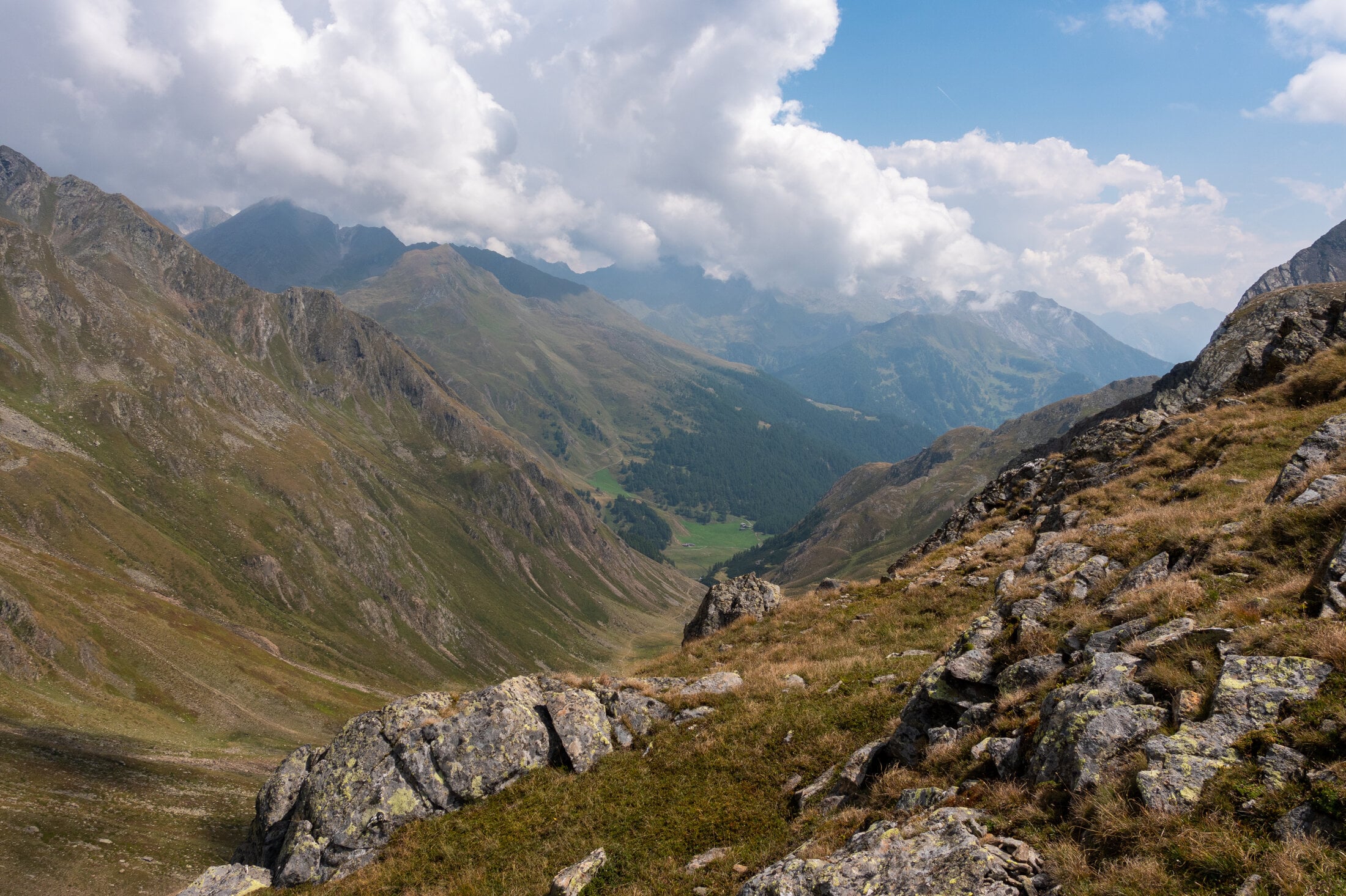
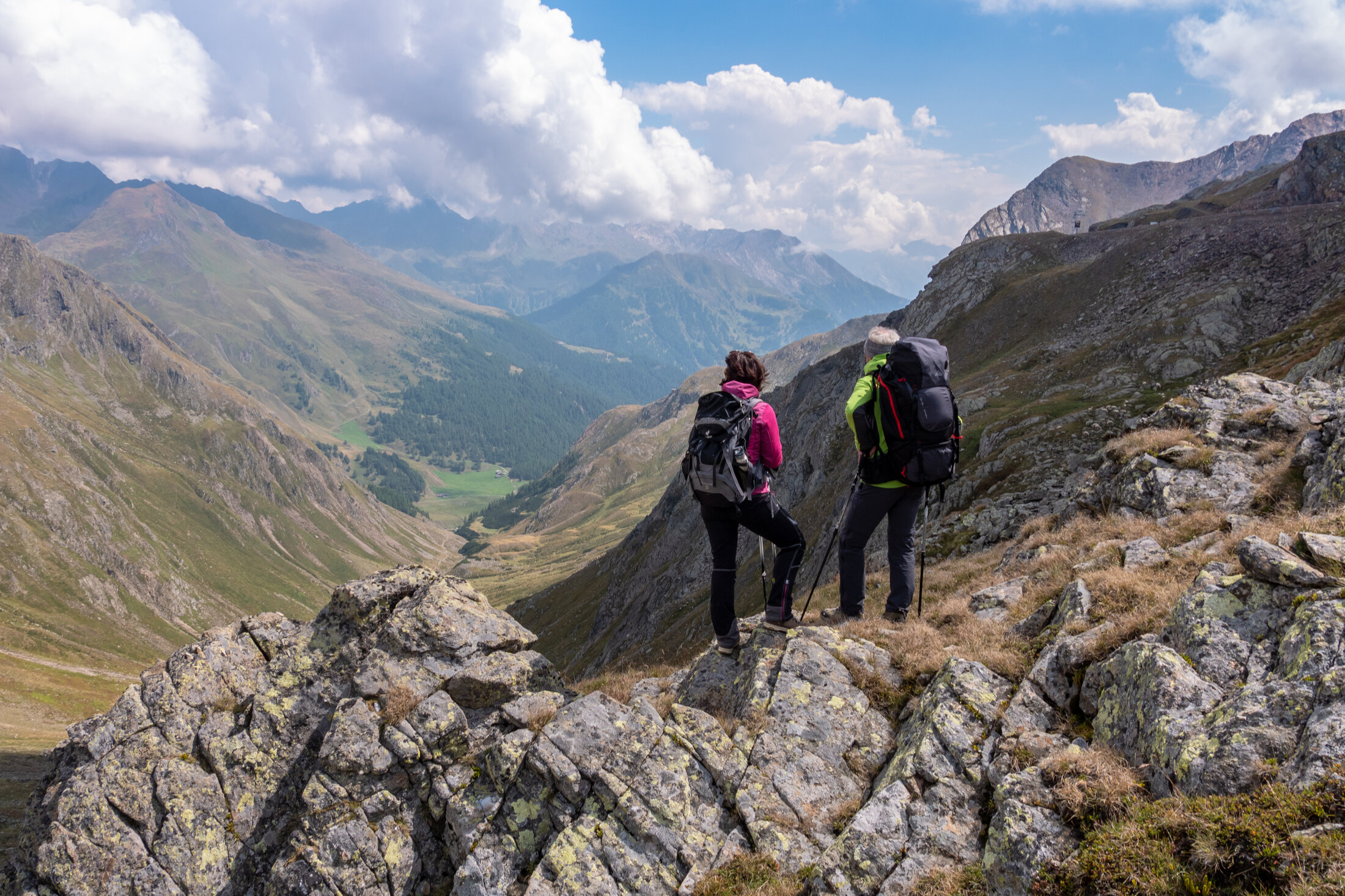
This E5 segment in high-alpine terrain is physically challenging and full of scenic highlights. Starting in the mountaineering village of Vent, a rather steep trail will take you across the Ramoljoch saddle (3,189 m) to Obergurgl. Right below the Ramolhaus Hut, there is the Piccard rope bridge across the Gurgler Ferner gorge. You will also be passing the Langtalereck Hut along the way. Make sure to stop at the viewing point on your way down. The views of the Gurglertal valley and the massive peaks at the end of the Ötztal valley are absolutely breathtaking. This challenging hike goes through the Ötztal Nature Park and the mystical Arolla Pine Forest before ending in Obergurgl, the highest Austrian village with a church at 1,930 m.
Map & elevation profile
The Tour
This E5 segment in high-alpine terrain is physically challenging and full of scenic highlights. Starting in the mountaineering village of Vent, a rather steep trail will take you across the Ramoljoch saddle (3,189 m) to Obergurgl. Right below the Ramolhaus Hut, there is the Piccard rope bridge across the Gurgler Ferner gorge. You will also be passing the Langtalereck Hut along the way. Make sure to stop at the viewing point on your way down. The views of the Gurglertal valley and the massive peaks at the end of the Ötztal valley are absolutely breathtaking. This challenging hike goes through the Ötztal Nature Park and the mystical Arolla Pine Forest before ending in Obergurgl, the highest Austrian village with a church at 1,930 m.
Regions & Places
Austria (Country)
Tyrol (Province)
Bezirk Imst (District)
Ötztal (Tourism area)
Gurgl (Tourism area)
Vent (Tourism area)
Gemeinde Sölden (Commune)
Mountain areas
Alps (Mountain area)
Ötztal Alps (Mountain area)
Modified at 24.03.2026 · Created at 07.09.2018
Details
Characteristics
Linear route
Way types
Hiking difficulty
Alpine hiking trail in harsh, steep terrain - there may be easy climbing sections (I UIAA), steep grassy slopes, scree, easy snowfields and glacier passages. Often pathless terrain with exposed sections and the risk of falling.
Arrival
Public transit
Enjoy a both comfortable and relaxing train ride to the train station in Ötztal Bahnhof. You get off the train in ÖTZTAL Bahnhof where you change to a public bus or local taxi. The current bus schedule can be found at: http://fahrplan.vvt.at
Getting there
The Ötztal is a southern side valley of the Inn valley. For your arrival by car, you can plan the best route from your home town with the route planner online at https://www.google.at/maps
Current information
Wednesday, 29.07.
Sun, clouds and warm, low risk of thunderstorms
Morning
18 °C
20%
Rainfall risk
Afternoon
32 °C
50%
Rainfall risk
Thursday, 30.07.
Lots of sunshine
Midsummer-like hot
Midsummer-like hot
Morning
17 °C
0%
Rainfall risk
Afternoon
34 °C
20%
Rainfall risk
The tour is within these protected areas.
Naturpark Ötztal (Protected area)
Ruhegebiet Ötztaler Alpen (Protected area)
Ötztaler Alpen (Protected area)