")

Long Distance Hiking
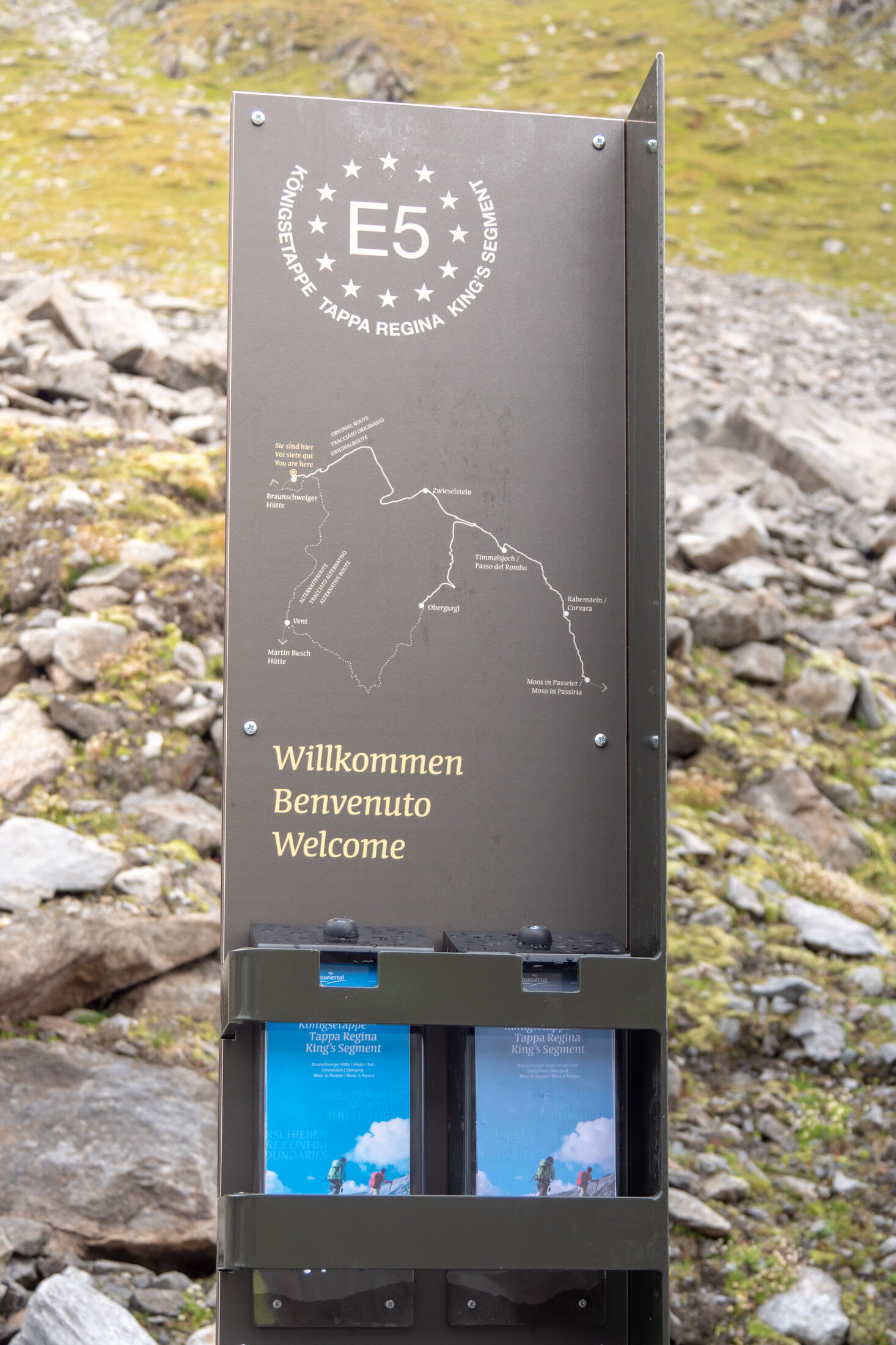
European E5 long-distance hiking trail – King's Segment – Braunschweiger Hut to Vent (alternative route)
Ötztal
Medium
Key facts
6:30 h
Duration
16.8 km
Length
450 m
Ascent
1310 m
Descent
2,994 m
Max. altitude
1,892 m
Min. altitude
Best Season
Jan
Feb
Mar
Apr
May
Jun
Jul
Aug
Sep
Oct
Nov
Dec
Description
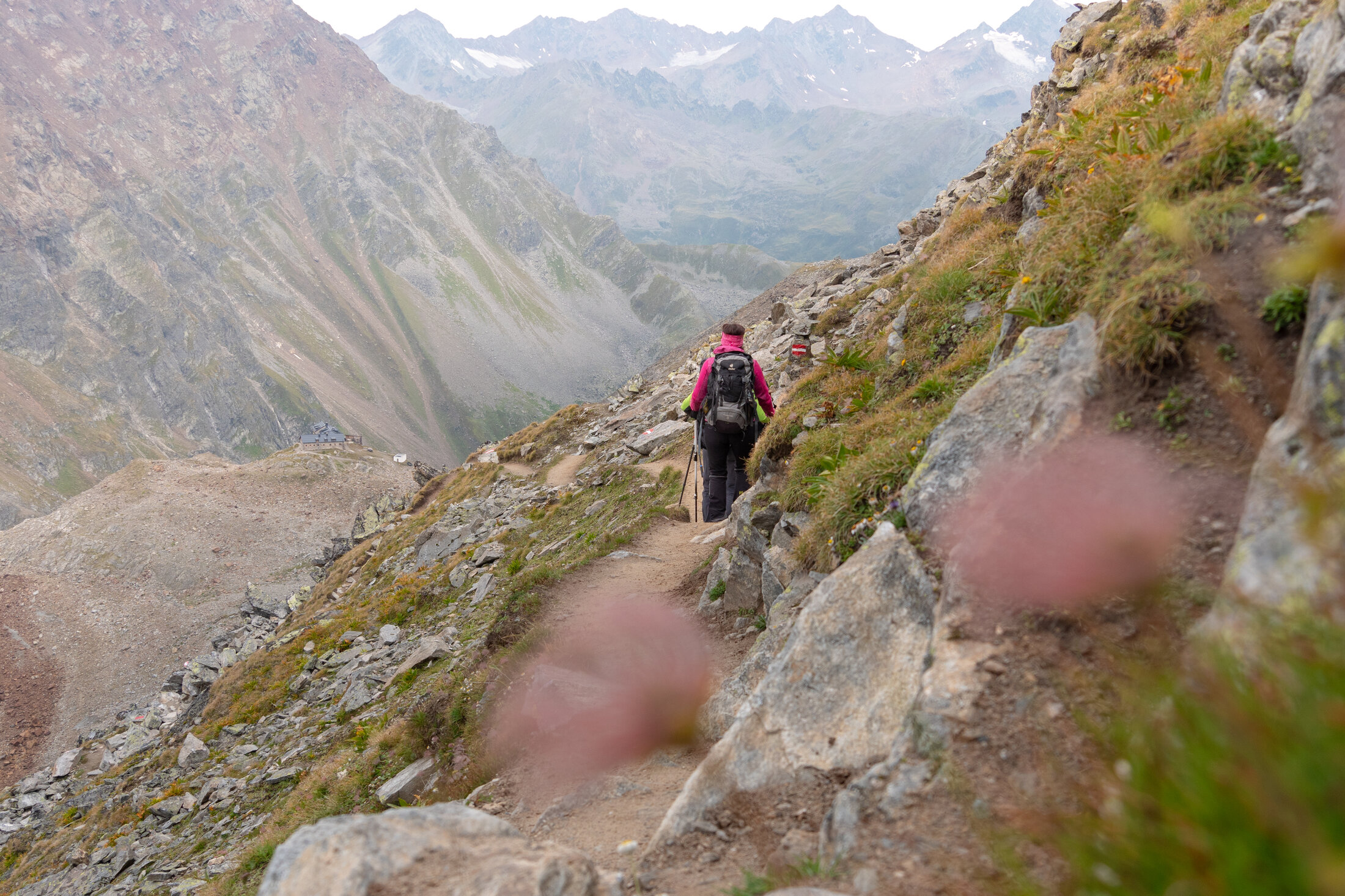
This particularly challenging segment of the trail starts at the Braunschweiger Hut (2,758 m) with a rather steep and difficult ascent to the Pitztaler Jöchl saddle (3,000 m), the highest point of this E5 segment. Once you reach the saddle, you will be rewarded with spectacular views of the Braunschweiger Hut, the Wildspitze mountain, the Rettenbachtal valley and the Riffelsee lake. You may encounter large snowfields in spring and early summer. There is an alternative shorter route via the Rettenbachjoch saddle. Both ways lead to the Rettenbachferner glacier, where a bus will take you through the Rosi Mittermaier tunnel to the Tiefenbachferner glacier. From there, the Vent Panoramic Trail slopes past cattle herds, the Weißkarsee lake and beautiful meadows down along the magnificent Ventertal valley before reaching the famous mountaineering village of Vent (1,890 m) with its quaint restaurants and inns.
Map & elevation profile
The Tour
This particularly challenging segment of the trail starts at the Braunschweiger Hut (2,758 m) with a rather steep and difficult ascent to the Pitztaler Jöchl saddle (3,000 m), the highest point of this E5 segment. Once you reach the saddle, you will be rewarded with spectacular views of the Braunschweiger Hut, the Wildspitze mountain, the Rettenbachtal valley and the Riffelsee lake. You may encounter large snowfields in spring and early summer. There is an alternative shorter route via the Rettenbachjoch saddle. Both ways lead to the Rettenbachferner glacier, where a bus will take you through the Rosi Mittermaier tunnel to the Tiefenbachferner glacier. From there, the Vent Panoramic Trail slopes past cattle herds, the Weißkarsee lake and beautiful meadows down along the magnificent Ventertal valley before reaching the famous mountaineering village of Vent (1,890 m) with its quaint restaurants and inns.
Regions & Places
Austria (Country)
Tyrol (Province)
Bezirk Imst (District)
Ötztal (Tourism area)
Pitztal (Tourism area)
Vent (Tourism area)
Sölden (Tourism area)
Sankt Leonhard im Pitztal (Commune)
Gemeinde Sölden (Commune)
Mountain areas
Alps (Mountain area)
Ötztal Alps (Mountain area)
Modified at 24.03.2026 · Created at 07.09.2018
Details
Characteristics
Linear route
Way types
Arrival
Public transit
Enjoy a both comfortable and relaxing train ride to the train station in Ötztal Bahnhof. You get off the train in ÖTZTAL Bahnhof where you change to a public bus or local taxi. The current bus schedule can be found at: http://fahrplan.vvt.at
Getting there
The Ötztal is a southern side valley of the Inn valley. For your arrival by car, you can plan the best route from your home town with the route planner online at https://www.google.at/maps
Current information
Wednesday, 29.07.
Sun, clouds and warm, low risk of thunderstorms
Morning
18 °C
20%
Rainfall risk
Afternoon
32 °C
50%
Rainfall risk
Thursday, 30.07.
Lots of sunshine
Midsummer-like hot
Midsummer-like hot
Morning
17 °C
0%
Rainfall risk
Afternoon
34 °C
20%
Rainfall risk
The tour is within these protected areas.
Naturpark Ötztal (Protected area)
Ötztaler Alpen (Protected area)
Ruhegebiet Ötztaler Alpen (Protected area)