


Cable car hiking: Gaislachkogl
Description
Ascent with the Gaislachkogl cable car to the Gaislachkogel middle station
Hiking: Gaislachkogel middle station - Gaislachkogl upper station - Sölden
Map & elevation profile
The Tour
Ascent with the Gaislachkogl cable car to the Gaislachkogel middle station
Hiking: Gaislachkogel middle station - Gaislachkogl upper station - Sölden
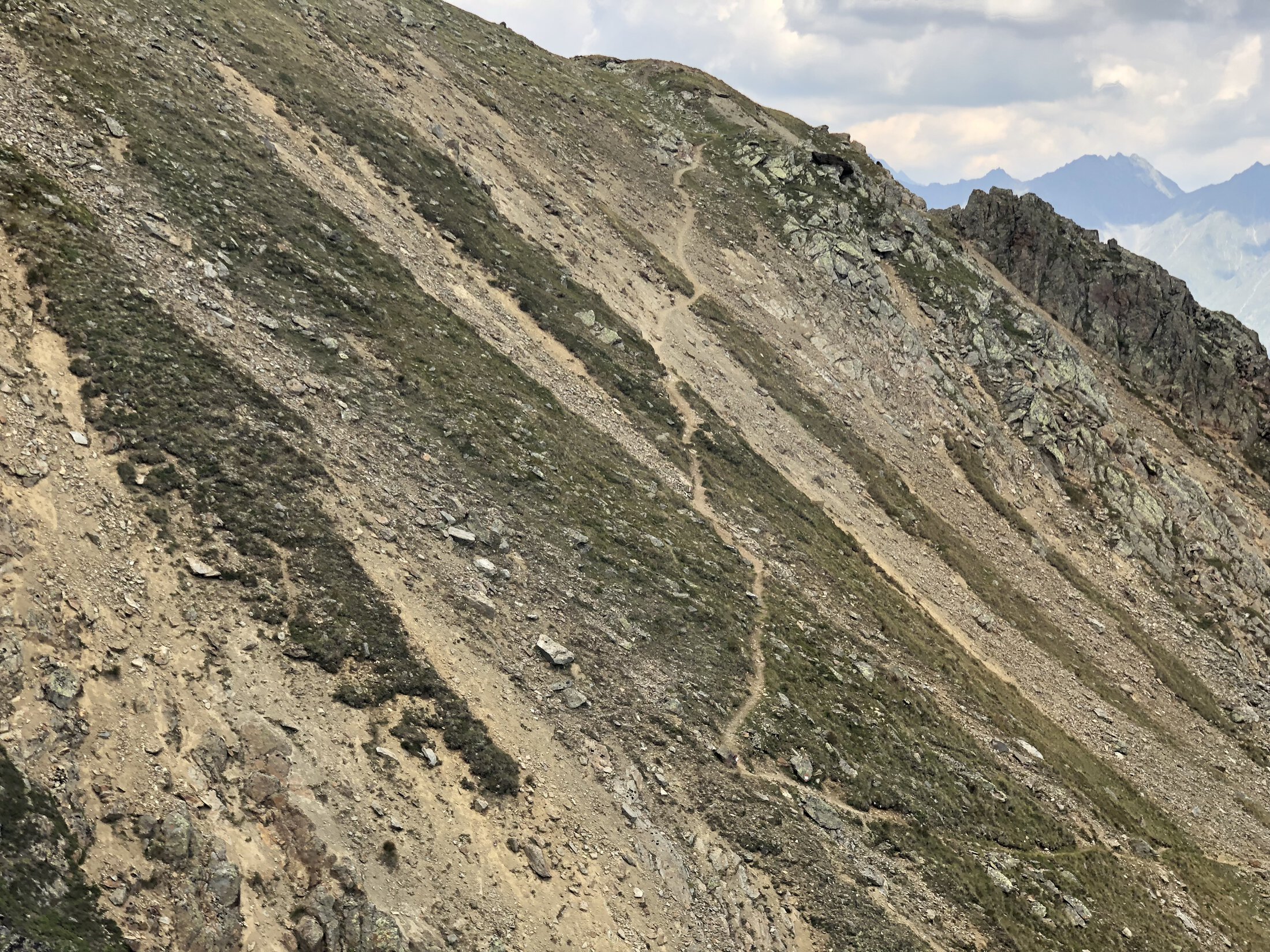
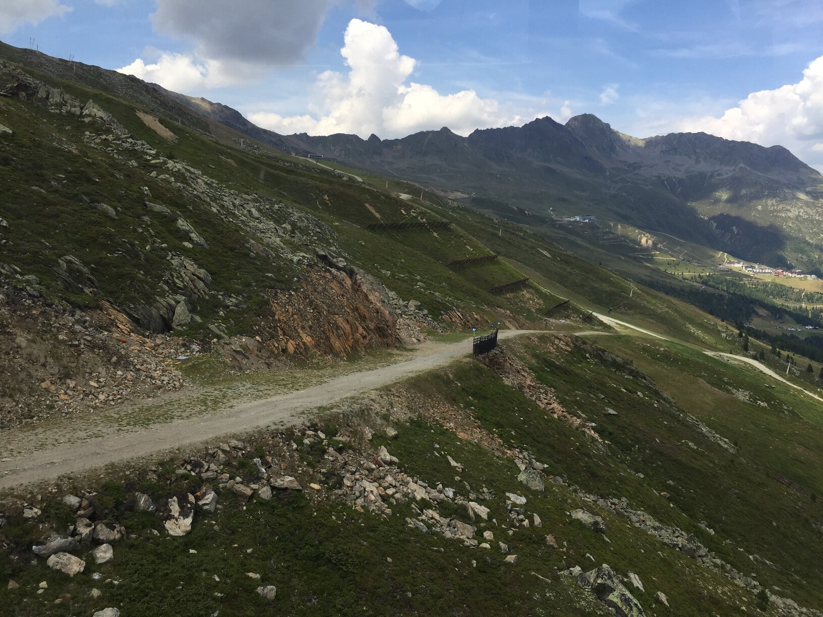
From the middle station of the Gaislachkogl cable car, a wide gravel path leads uphill over the ski slope to the Gaislachkogl. Where the alpine meadows bloom, you encounter native grazing animals such as sheep, cows, and horses. Along the idyllic mountain slopes, which are hardly recognizable in winter as a ski slope, the path leads uphill and over the Wasserkar to the Gaislachkogl. This beautiful, moderately difficult hike offers an authentic mountain experience with a magnificent view along the route.
Regions & Places
Mountain areas
Details
Characteristics
Way types
Safety guidelines
Red mountain trails are moderately difficult: some narrow and steep, but secured walking and climbing sections await hikers. The corresponding signs are on a yellow background and display a red circle as a difficulty rating.
Moderately difficult mountain trail; suitable for sure-footed and experienced mountain hikers; good physical condition, mountain experience, and mountain equipment (see under equipment) necessary. Please check the current weather report at: https://www.oetztal.com/en/summer.html
Recommended maps
Directions
From the middle station of the Gaislachkogl cable car, a wide gravel path leads above the ski slope uphill. At the end of the path, you turn right, pass under the Gaislachkogl cable car, and ascend the steep slope into the Wasserkar. On the mountain ridge, you follow the long ridge trail until you reach the upper station of the Gaislachkogl cable car. After arriving at the Gaislachkogl cable car, continue along a rocky path past the Ice Q restaurant and the 007 ELEMENTS adventure world to the summit cross of the Gaislachkogl.
Arrival
Public transit
Travel comfortably and safely by train to the Ötztal railway station. The final station or exit point is the ÖTZTAL station. Afterwards, you can travel conveniently and quickly with public transport or local taxi companies through the entire valley to your desired destination. The current bus schedule is available at: http://fahrplan.vvt.at
Starting point
Getting there
The car journey to the ÖTZTAL. Located in Tyrol, the ÖTZTAL branches southward as the longest side valley of the Eastern Alps. Traveling by car leads visitors through the Inn Valley to the valley entrance and then along the Ötztal. In addition to the toll motorway, country roads can also be used. You can quickly and conveniently plan your trip with the route planner: To the route planner: https://www.google.at/maps
Parking
In Sölden, the following parking options are available:
- Gaislachkogl cable car + underground garage
All parking spaces are free during the day.
For parking for several days (e.g., hut tour):
- Postplatz, parking ticket available at the Sölden information center
- Gaislachkogl cable car parking garage, parking ticket either online or directly at the Gaislachkogl cable car ticket office