Hiking Trail recommended route

Breslauer Hut

Hiking Trail · Vent closed
Logo Ötztal
Responsible for this content
Ötztal Verified partner 
  • Breslauer Hut
    Breslauer Hut
    Photo: Katharina Nösig, Ötztal

Selected alternatives for you
    VENT -> Stableinalm -> BRESLAUER HUT
    closed
    moderate
    Distance 4.6 km
    2:30 h
    957 m
    0 m
    2,844 m
    1,886 m

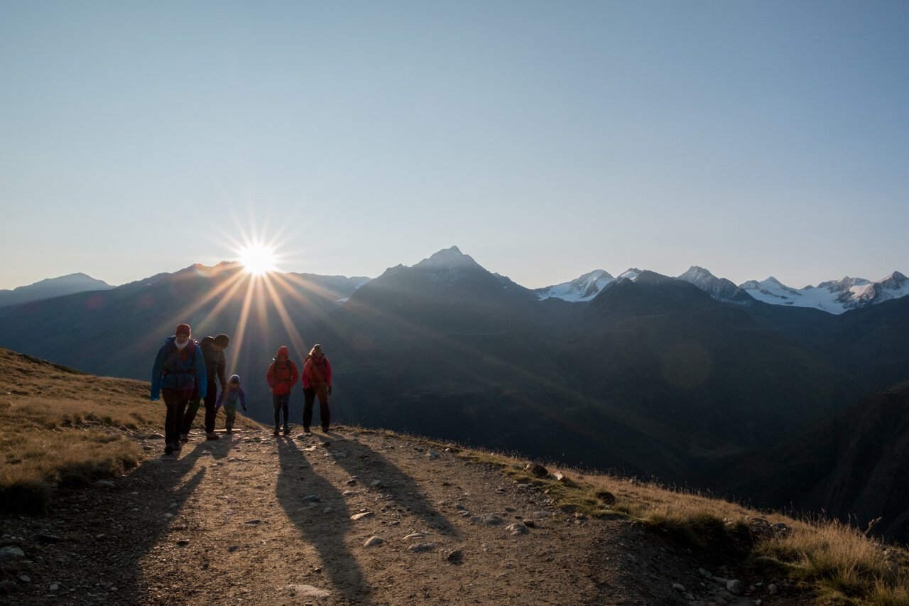
    From Vent, you either hike along a very wide, consistently ascending path or a somewhat steeper path below the chairlift to the Stableinalm, chairlift mountain station. From the Stableinalm, first moderately on a wide path, later steeply ascending on a narrow mountain trail to the Breslauer Hut.


    Author’s recommendation

    Profile picture of Roland Grüner
    Author
    Roland Grüner 
    Logo Ötztal
    Responsible for this content
    Ötztal  Verified partner 
    Difficulty
    moderate
    Overall difficulty
    moderate

    Derived from the technical difficulty and the stamina requirements.

    Experience
    Landscape
    Highest point
    2,844 m
    Lowest point
    1,886 m
    Best time of year
    Jan
    Feb
    Mar
    Apr
    May
    Jun
    Jul
    Aug
    Sep
    Oct
    Nov
    Dec

    Track types

    Show elevation profile

    Rest stops

    panorama restaurant Stablein
    Breslauer Hütte

    Safety information

    Moderate mountain trail; suitable for sure-footed and experienced mountain hikers; good physical condition, mountain experience, and equipment (see under Equipment) necessary. Please check the current weather report at: https://www.oetztal.com/de/sommer.html

    Tips and suggestions

    More information about hiking in the Ötztal: https://www.oetztal.com/wandern 


    Public transport

    Travel comfortably and safely by train to the Ötztal train station. The final stop or exit point is the ÖTZTAL station. Then travel conveniently and quickly through the entire valley to your desired destination by public bus or local taxi companies! The current bus timetable is available at: http://fahrplan.vvt.at


    Directions

    Vent is located in western Austria in the state of TIROL, in a southern side valley of the Inn valley - the ÖTZTAL. For your arrival by car, plan the optimal route from your home location with the route planner online: https://www.google.at/maps


    Parking

    The following parking options are available in Vent:

    In front of the village and at the base station of the chairlift (paid)

    Coordinates

    DD
    46.859061, 10.913576
    DMS
    46°51'32.6"N 10°54'48.9"E
    UTM
    32T 645861 5191279
    w3w 
    ///shimmy.encrypt.thrillers
    Get there by train, car, bike, or on foot!

    Book recommendation by the author

    Ötztal Hiking Book | Helga Marberger | Publisher: Tyrolia

    Local information Vent / available at Information Vent

    Author’s map recommendations

    Kompass #042 | Inner Ötztal and Pitztal, Gurgler Valley, Venter Valley | 1:25,000

    Kompass #43 | Ötztal Alps, Ötztal, Pitztal | 1:50,000

    Freytag & Bernd WK 251 | Ötztal, Pitztal, Kaunertal, Wildspitze | 1:25,000

    Kompass | Bike & Hiking Map Ötztal | 1:35,000

    Equipment

    Appropriate equipment such as breathable and weather-appropriate outdoor clothing, ankle-high hiking boots, wind, rain, and sun protection, a cap, possibly gloves, is required for all hikes and routes. Carrying a first aid kit, a mobile phone, and possibly a hiking map, as well as sufficient provisions for hikes without dining options, is necessary.

    Localization

    Parts of this content were machine translated using German as the source language

    Similar routes nearby

    • Rofenhöfe 2014 m 51
    • Brandenburgerhaus
    • Hochjoch Hospiz
    • Similaunhütte
    • Vernagthütte
     These suggestions were generated by our system
    Status
    closed
    Difficulty
    moderate
    Overall difficulty
    moderate

    Derived from the technical difficulty and the stamina requirements.

    Distance
    4.6 km
    Duration
    2:30 h
    Ascent
    957 m
    Highest point
    2,844 m
    Lowest point
    1,886 m
    Scenic Refreshment stops available Linear route

    Statistics

    • Content
    • Show images Hide images
    Features
    Maps and trails
    Nothing selected - click and drag in the elevation profile to zoom
    Distance
    Duration
    Ascent
    Descent
    Elevation profile