

Bike & Hike Strad - Haiminger Alm - Haiminger Kreuz
Map & elevation profile
The Tour
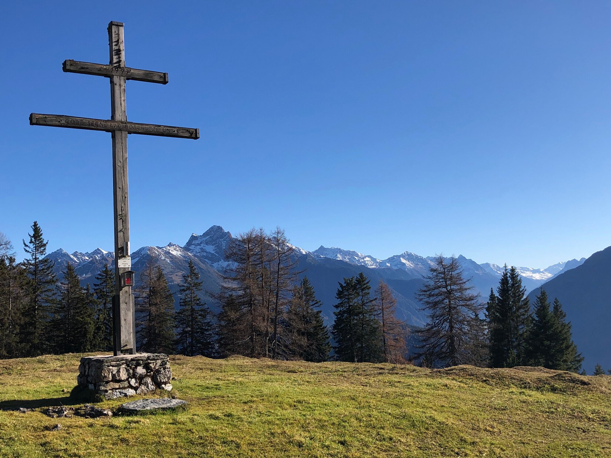
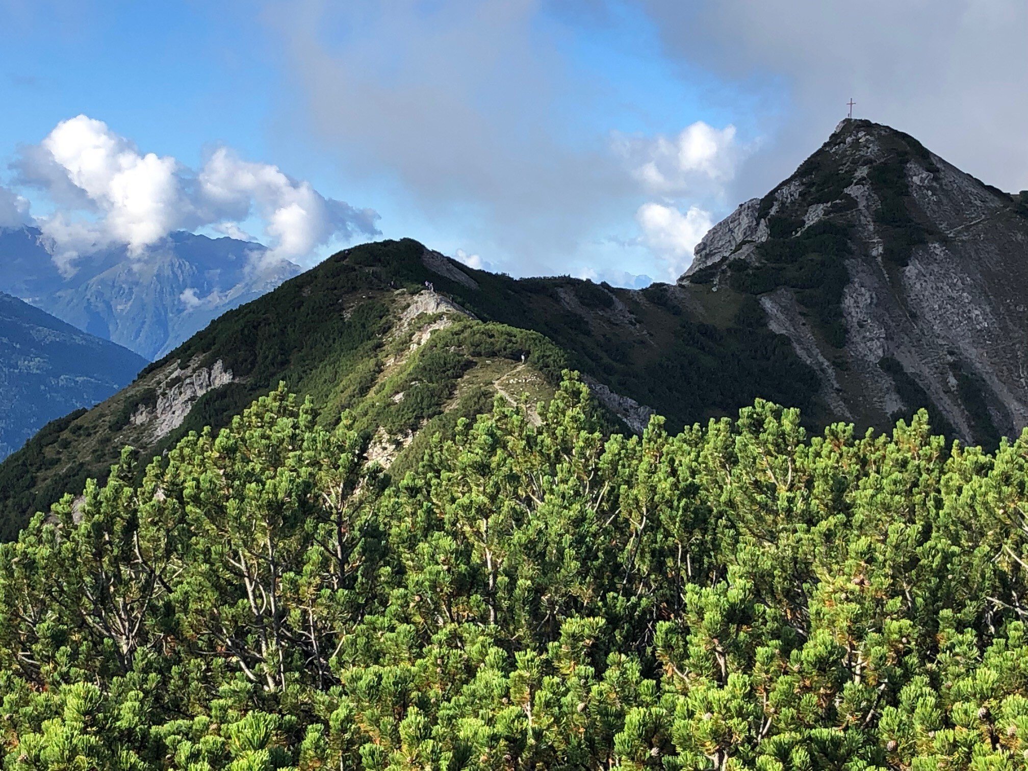
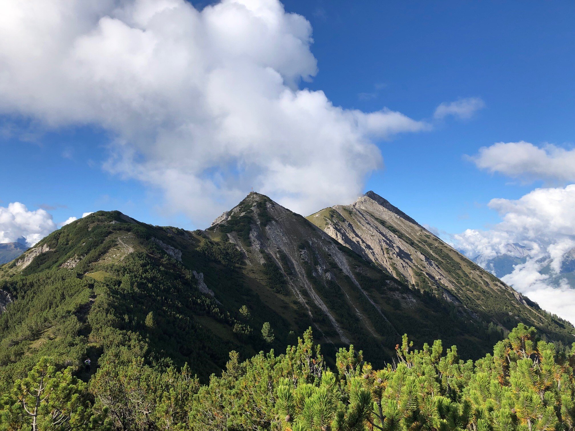
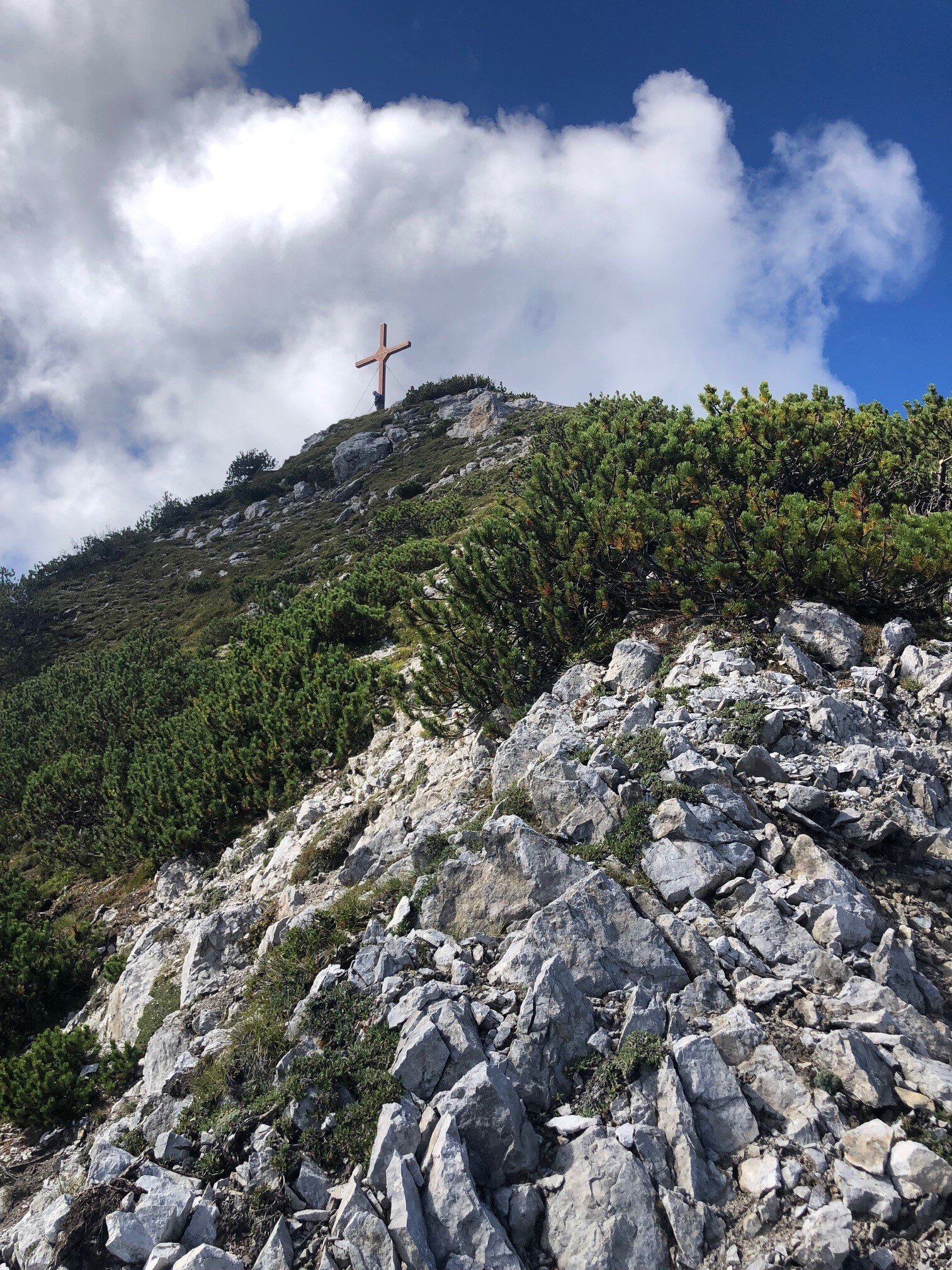
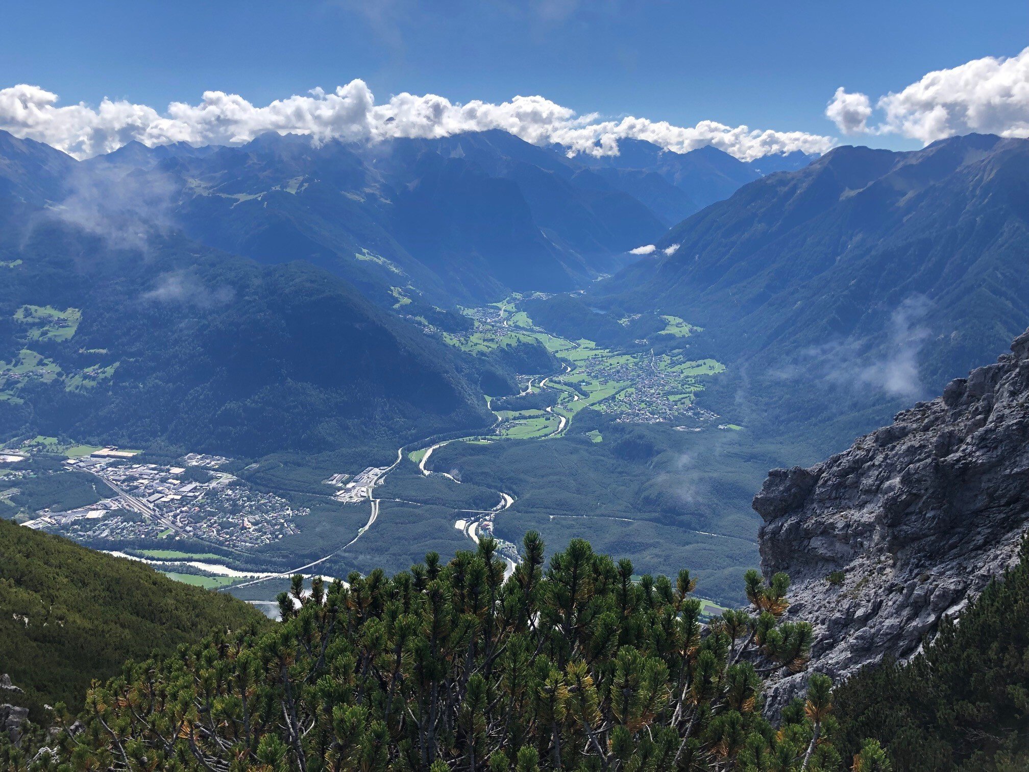
The impressive Tschirgant massif is a highlight for every hiker. East of the Tschirgant lies the destination of this route, the Haiminger Kreuz. You start on the north side of the mountain in Strad. There the route begins with the mountain bike and involves a climb of over 9 km, climbing a consistently steep 1000 m in altitude. Shortly before the Haiminger Alm (1786 m), the path becomes slightly flatter and you can recover a bit until you finally reach the idyllic and beautifully situated alm. This is now the end point for the bike. Please be careful not to block any path when locking your bike. After a short stop at the alm, you continue on foot. Among dwarf pines, you first hike a little steeper uphill until you reach a pleasant traverse on the mountain ridge, with impressive panorama views. The last section to the summit becomes steeper and more exposed again. Once at the top, you can enjoy the magnificent view over the Inn valley into the Ötztal and as far as the Timmelsjoch.
Ideal E-Bike & Hike route!
Regions & Places
Mountain areas
Details
Characteristics
Way types
Safety guidelines
A good fitness level is required for the bike section up to the Haimingerhütte, as the ascent is consistently steep. The use of an e-bike is recommended here.
Moderate mountain path; suitable for surefooted mountain hikers; good physical condition, mountain experience, and mountain equipment (see under equipment) are necessary. Please note the current weather report at: https://www.oetztal.com/en/summer.html
Additional information
More information about hiking & mountaineering in the Ötztal: https://www.oetztal.com/wandern
More information about biking & cycling in the Ötztal: https://www.oetztal.com/biken
Directions
The impressive Tschirgant massif is a highlight for every hiker. East of the Tschirgant lies the destination of this route, the Haiminger Kreuz. You start on the north side of the mountain in Strad. There the route begins with the mountain bike and involves a climb of over 9 km, climbing a consistently steep 1000 m in altitude. Shortly before the Haiminger Alm (1786 m), the path becomes slightly flatter and you can recover a bit until you finally reach the idyllic and beautifully situated alm. This is now the end point for the bike. Please be careful not to block any path when locking your bike. After a short stop at the alm, you continue on foot. Among dwarf pines, you first hike a little steeper uphill until you reach a pleasant traverse on the mountain ridge, with impressive panorama views. The last section to the summit becomes steeper and more exposed again. Once at the top, you can enjoy the magnificent view over the Inn valley into the Ötztal and as far as the Timmelsjoch.
Arrival
Starting point
Getting there
Coming from Imst, drive towards Tarrenz. From Tarrenz, continue about 1 km and then turn right to Strad. From there, drive into the forest and you can park near the fitness trail.
Parking
In Strad there is parking in the forest near the fitness trail.
Current information
Midsummer-like hot
Equipment
We recommend wearing bike protective gear (elbow pads, knee pads, helmet, back protector, ...) on all mountain bike routes. Make sure you only use a bike that meets today's quality standards. When on bike & hike routes, it is always advisable to carry a lock.
For hiking, wear appropriate equipment such as breathable and weather-adapted outdoor clothing. Ankle-high hiking boots, wind, rain and sun protection, a hat, and possibly gloves are required for all hikes and routes. Carrying a first aid kit, a mobile phone, and possibly a hiking map, as well as enough provisions for hikes without refreshment options, is necessary.