Start time: 10:00
25.5km | 1,900hm
We respect your
right to privacy!
Cookie settings
These cookies are absolutely necessary for the operation of this site and enable safety related functionalities, for example. Additionally, this type of cookie is as well used to save your personal cookie settings.
In order to further improve both our offer and website, we collect anonymized data for statistics and analyzes. By means of these cookies we can, for example, analyze the number of visitors and the effect of certain pages on our website by optimizing our content.
We use these cookies to improve usability of the site for you. For example, based on an accommodation search you already made, you can conveniently access the same lodging when you visit our website again.
These cookies are used to display personalized content that matches your interests. It enables us to provide you with offers that are particularly relevant to your personally planned trip.
Start time: 10:00
25.5km | 1,900hm
Late registration on site not possible!
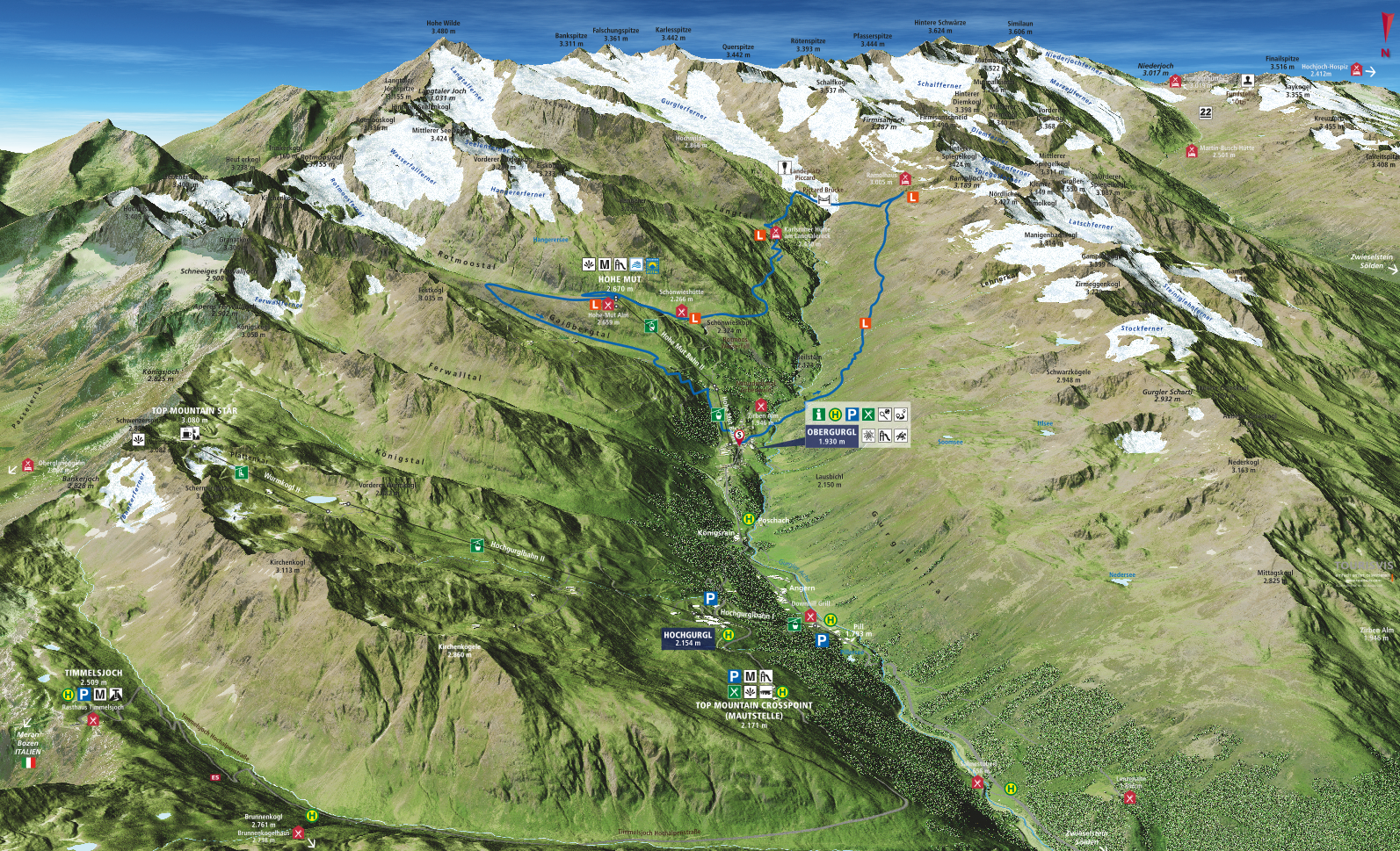
A trail at half marathon distance. Dreamlike scenery, beautiful trails - technically demanding. The start is at just under 2,000m above sea level in Obergurgl. The participants do not have much time to warm up, because it goes immediately on a good 8 km and 700m to the highest point of the race. At the Ramolhaus at over 3,000m the intermediate time taken, the route leads over a technically very demanding downhill to the Piccard bridge, where a breathtaking panorama of the Ötztal glacier world opens up. Continuing over the Schwärzenkamm to the Langtalereckhütte, the runners tackle the last 12 km of the race on the forest path to the Schönwieshütte. After a refreshment, the route runs into the beautiful Rotmoostal valley, where the fantastic natural spectacle accompanies the participants to the Hohe Mut Alm. Once at 2,670m, a downhill leads through the Gaisberg valley towards Obergurgl. The last 2 km the runners enjoy the cheers of the spectators until the finish.
Course
Elevation profile
GPX Data
Compulsory equipment
Track times
Depending on the measuring method, the actual kilometer and altitude details can vary between +/- 3%.