Start time: 11:00
13.7km | 800hm
We respect your
right to privacy!
Cookie settings
These cookies are absolutely necessary for the operation of this site and enable safety related functionalities, for example. Additionally, this type of cookie is as well used to save your personal cookie settings.
In order to further improve both our offer and website, we collect anonymized data for statistics and analyzes. By means of these cookies we can, for example, analyze the number of visitors and the effect of certain pages on our website by optimizing our content.
We use these cookies to improve usability of the site for you. For example, based on an accommodation search you already made, you can conveniently access the same lodging when you visit our website again.
These cookies are used to display personalized content that matches your interests. It enables us to provide you with offers that are particularly relevant to your personally planned trip.
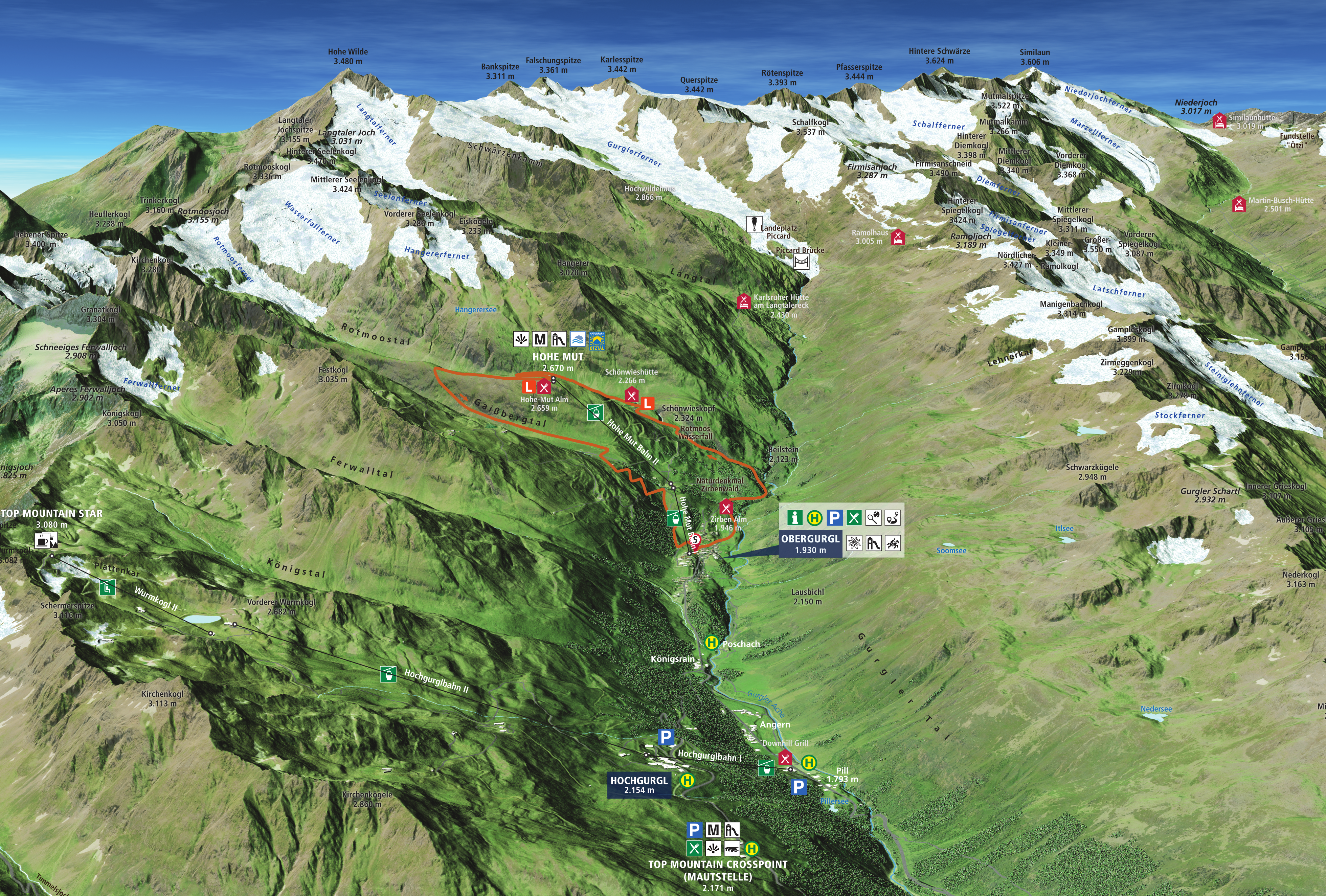
Trail for beginners. Dreamlike scenery, beautiful trails. The start is at just under 2,000m above sea level in Obergurgl. After 1 kilometer to warm up, the runners head into the pine forest. There a 3 kilometer long ascent awaits until the first refreshment station at the Schönwieshütte. After refreshments, the route continues into the beautiful Rotmoostal valley, where the fantastic natural spectacle accompanies the participants to the Hohe Mut Alm and the second refreshment station. Arrived at 2,670m, a downhill leads through the Gaisberg valley towards Obergurgl. The last 2 km the runners enjoy the cheers of the spectators until the finish.
GPX Data
Elevation profile
Compulsory equipment
Depending on the measuring method, the actual kilometer and altitude details can vary between +/- 3%.